The Indus Waters Treaty cannot be understood merely as a diplomatic document signed in 1960. It belongs to a much longer history in which rivers, canals, agriculture, empire, partition, and national security became inseparable. The Indus basin was never a passive landscape waiting to be divided by modern states. It was a living hydraulic system that shaped settlement, food production, trade, social organisation, and political power across northwestern Bharat and the wider subcontinent.
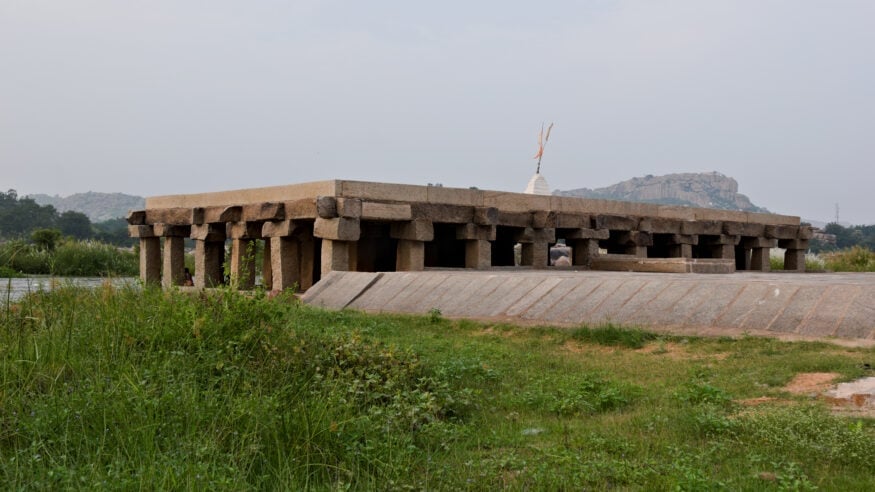
Long before the language of international law entered the discussion, the Indus and its tributaries had already produced one of the world’s earliest urban civilisations. Harappa, Mohenjo-daro, Dholavira, Rakhigarhi, and related sites demonstrate that water management was central to public life. Wells, drains, bathing areas, reservoirs, granaries, and planned streets were not ornamental achievements; they reflected a disciplined civic understanding that society survives only when water is treated as a shared responsibility.
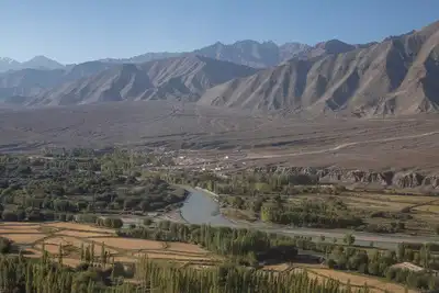
This civilisational memory is important because it prevents the Indus question from being reduced to a narrow India-Pakistan dispute. The rivers were older than both modern states. They nourished fields, supported trade corridors, enabled urban planning, and helped define the cultural geography of Punjab, Sindh, Jammu and Kashmir, Ladakh, and the northwestern plains. In that sense, the Indus system was not simply a natural resource. It was a civilisational infrastructure.
The technical character of the basin made later political division especially difficult. The main rivers and tributaries generally flowed from the Himalayan and trans-Himalayan zones toward the southwest, while the irrigation networks built from them often carried water across administrative and later national boundaries. A line drawn on a map could assign territory to one state or another, but it could not easily separate headworks, canals, command areas, seasonal flows, and agricultural dependencies that had developed as one connected system.
During British colonial rule, this older hydraulic geography was transformed into one of the largest canal irrigation networks in the world. Between the nineteenth and early twentieth centuries, projects such as the Upper Bari Doab Canal, Lower Chenab Canal, Triple Canals Project, and Sutlej Valley Project converted large stretches of semi-arid land into intensively irrigated agricultural zones. Cotton, wheat, and other crops expanded under a system in which engineering, revenue policy, military recruitment, and colonial settlement strategy worked together.
This canal expansion is often described as an engineering achievement, and in strictly technical terms it was formidable. Yet it was also a political project. Colonial power used irrigation to stabilise agrarian revenue, populate canal colonies, increase agricultural output, and reshape landholding patterns. The result was a basin whose economic life depended on infrastructure designed under imperial priorities rather than under a sovereign Indic civilisational framework.
The problem became acute in 1947. Partition divided not only people, provinces, and institutions, but also the operational logic of irrigation. Some crucial headworks remained on the Indian side, while many downstream canal command areas lay in Pakistan. The Madhopur headworks on the Ravi and the Ferozepur headworks on the Sutlej became symbols of a larger structural dilemma: the system had been built as one network, but sovereignty had been split between two states born in violence and mistrust.
In April 1948, the water dispute became immediate when supplies from eastern river headworks to certain Pakistani canals were interrupted after temporary standstill arrangements expired. The episode reinforced Pakistan’s fear of upstream vulnerability and India’s concern that a sovereign state could not be permanently bound by colonial-era canal arrangements that ignored new political realities. From that point onward, the Indus question ceased to be only an irrigation issue. It became a test of statehood, security, and regional diplomacy.
The World Bank eventually entered the dispute as a mediator. According to the World Bank’s own summary of the treaty’s origins, the Indus Waters Treaty was signed in 1960 after nine years of negotiations between India and Pakistan, with the Bank also becoming a signatory in a limited procedural role. The final arrangement did not attempt a fully integrated joint management model. Instead, it divided the six main rivers into two broad groups.
Under the treaty, the three western rivers, the Indus, Jhelum, and Chenab, were allocated primarily to Pakistan, while the three eastern rivers, the Ravi, Beas, and Sutlej, were allocated primarily to India. India retained certain permitted uses on the western rivers, especially non-consumptive uses such as hydropower subject to technical design conditions. Pakistan received a transition period and replacement works so that canals previously dependent on eastern rivers could be supplied from western rivers through new dams, barrages, and link canals.
This was a striking model because it partitioned rivers rather than truly sharing them. In legal terms, the treaty created clarity. In hydrological terms, it imposed a political architecture on a naturally interconnected system. In strategic terms, it gave both countries a framework that reduced immediate conflict while preserving deep anxieties about control, storage, timing, and infrastructure design.
The treaty also established the Permanent Indus Commission, with commissioners from both countries, to support communication, data exchange, inspections, and dispute handling. It created different procedures for questions, differences, and disputes, including the possibility of a Neutral Expert or a Court of Arbitration. This layered design explains why the treaty survived wars and crises for decades. It gave both sides a technical vocabulary through which political mistrust could at least be managed.

Yet longevity should not be confused with perfection. The Indus Waters Treaty was negotiated in a world very different from the present. It emerged before contemporary climate science, before modern concerns about glacial retreat, before today’s scale of hydropower demand, before large-scale groundwater stress became central to agricultural policy, and before terrorism and hybrid conflict reshaped India’s security calculations. A treaty that was once praised for stability now faces pressures its original designers could not fully anticipate.
Climate change is especially significant. The Indus basin depends on a complex combination of snowmelt, glacier-fed flows, winter precipitation, and monsoon dynamics. Any shift in timing can affect irrigation scheduling, reservoir planning, flood risk, sediment management, and hydropower generation. For farmers, these are not abstract modelling questions. They determine sowing decisions, crop security, debt exposure, and the resilience of village economies.
The ancient Indus civilisation offers a sobering lesson in this regard. Archaeological and environmental research increasingly links long-term shifts in rainfall and river behaviour with changes in Harappan settlement patterns. The lesson is not that climate alone determines history, but that even sophisticated societies must adapt when water regimes change. The Indus basin has therefore always been a theatre of resilience as much as a theatre of conflict.
For Bharat, the Indus question also carries an emotional and civilisational weight. Rivers in the Indic imagination are not treated as lifeless channels of utility. They are associated with memory, duty, sacred geography, agriculture, pilgrimage, and community life. This does not replace the need for engineering precision or legal seriousness. Rather, it deepens the ethical frame within which water policy must be understood.
That ethical frame is consistent with the broader unity of dharmic traditions. Hindu, Buddhist, Jain, and Sikh civilisational streams have all preserved forms of reverence for life, restraint, stewardship, and responsibility. A mature discussion on the Indus must therefore avoid crude hatred and simplistic triumphalism. It should recognise legitimate national interests while also acknowledging that water mismanagement ultimately harms ordinary communities before it harms governments.
At the same time, civilisational restraint does not require strategic naivety. India’s concerns about cross-border terrorism, infrastructure rights, and the treaty’s asymmetries belong to the domain of national security. In 2025, India placed the treaty in abeyance after the Pahalgam terror attack, arguing that the framework of goodwill and cooperation had been undermined. This development showed that even a historically durable water treaty cannot remain insulated forever from the wider security environment.
The World Bank has repeatedly clarified that its role under the treaty is limited and procedural. It does not govern the rivers, rewrite the treaty, or decide the political relationship between India and Pakistan. Its role relates mainly to specified dispute-resolution mechanisms when requested under the treaty framework. This distinction matters because public debate often exaggerates the power of external institutions while underestimating the sovereign choices of the two states.
From a technical perspective, the most contentious issues often concern storage, pondage, spillway design, sediment flushing, drawdown levels, and hydropower structures on western rivers. These details may appear narrow, but they are central to treaty interpretation. A few metres in design elevation, the timing of reservoir operations, or the classification of a project can become diplomatically explosive when downstream trust is low.
The deeper problem is that the treaty attempted to stabilise a basin by separating rights, while the basin itself remains ecologically connected. Rivers carry water, sediment, risk, livelihoods, and memory across borders. They do not recognise the neat categories of legal drafting. This is why the Indus Waters Treaty remains both an achievement and a warning: it reduced the immediate danger of water war, but it could not erase the structural tension created when a continuous river system was divided by Partition.
A serious reading of the Indus Waters Treaty should therefore begin not in 1960, but with the rivers themselves. The Indus basin shaped urban civilisation, colonial engineering, agricultural expansion, Partition-era anxieties, and modern geopolitics. Its story reveals how water can bind communities, empower states, expose vulnerabilities, and test moral imagination. In the end, the rivers that shaped a civilisation continue to ask whether modern politics can rise to the discipline that water has always demanded.
Sources consulted for factual background include the original News18 article, the World Bank’s fact sheet on the Indus Waters Treaty, and publicly available historical summaries on the Indus Valley Civilisation and the treaty framework: News18, World Bank, and United Nations Treaty Collection.
Inspired by this post on Hindu Post.


Leave a Reply
You must be logged in to post a comment.