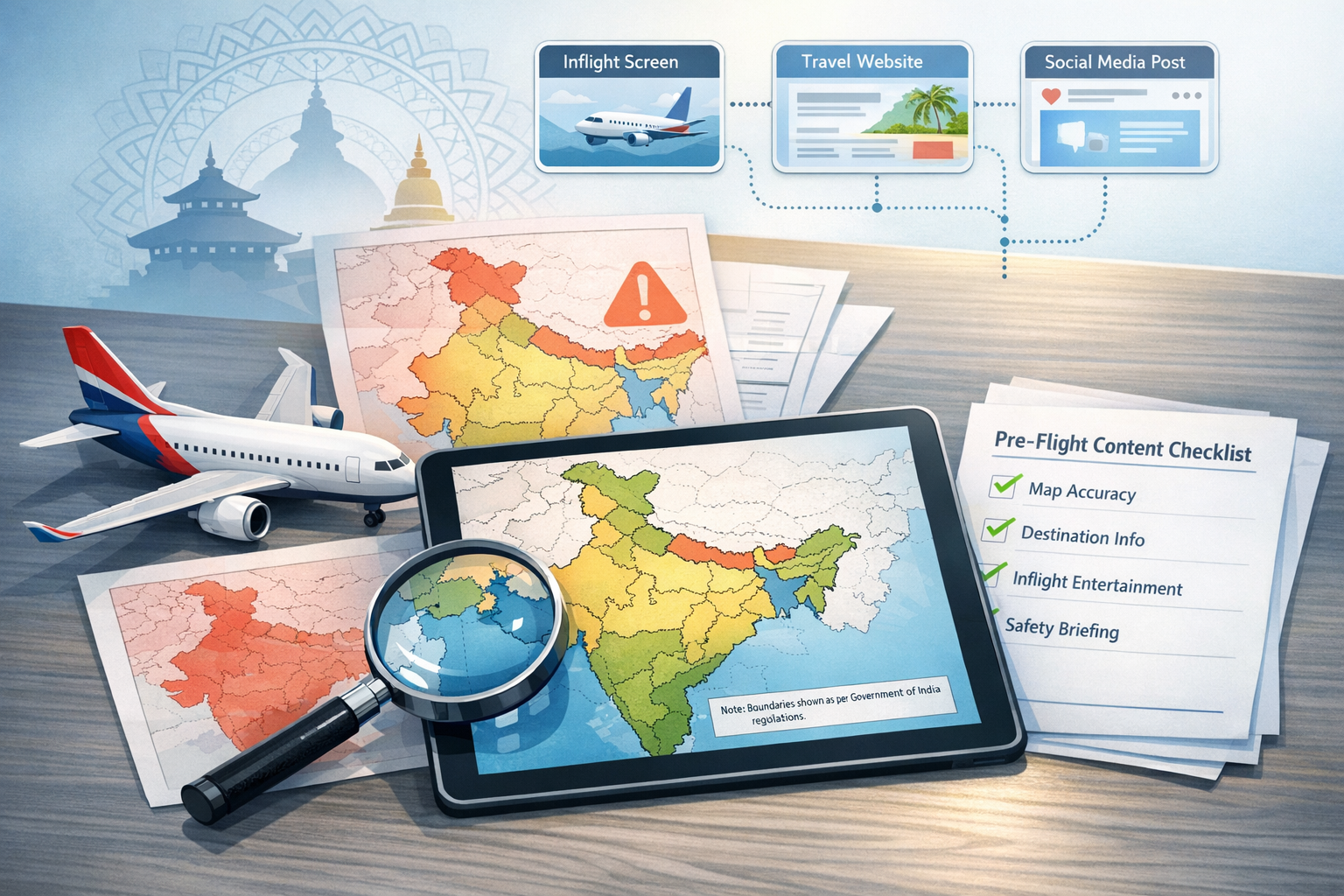
Nepal Airlines faced swift backlash after sharing a map in which parts of Jammu & Kashmir and North-East India appeared outside India’s borders, reportedly under Pakistan and China. The carrier removed the asset and issued a public apology, yet the episode amplified sensitivities around cartographic accuracy in South Asia, where lines on a map embody sovereignty, security, and collective memory.
In Indian cartographic practice, the Union Territories of Jammu and Kashmir and Ladakh, alongside the Northeastern state of Arunachal Pradesh, are integral parts of India. Any portrayal that suggests these territories lie within Pakistan or Chinawhether due to vendor assets, mislabeling, or noncompliant base mapsis interpreted as a misrepresentation with geopolitical ramifications. For audiences across the region, maps are not neutral visuals; they are powerful signals of national integrity and identity.
The modern digital content supply chain for airlines is intricate. Route maps, inflight screens, websites, and social posts frequently rely on third-party providers, stock libraries, and pre-built basemap tiles. A single unchecked vector tile, outdated raster, or stock graphic can rapidly replicate across platforms, transforming a quiet back-end lapse into a front-page brand crisis. The Nepal Airlines incident highlights this operational reality and the acute brand and reputational risks linked to cartographic oversight.
Technical cartography offers well-established safeguards. Best practice mandates the use of authoritative boundary datasets, rigorous version control, and consistent symbology for disputed or undelimited boundaries. Internationally, cartographers often distinguish de jure and de facto control through dashed or dotted lines, supported by a clear legend. Prominent textual disclaimers noting that boundary depictions may not be authoritative, accompanied by explicit source citations and timestamps, further reduce ambiguity and prevent the reuse of stale data.
Regulatory and policy norms in India raise the bar for accuracy. The Survey of India serves as the national authority for official boundary depictions, and the National Map Policy (2005) frames dissemination standards. Government guidance expects that India’s external boundaries be shown correctly and that digital products targeting Indian audiences conform to official references. While enforcement pathways vary by platform and jurisdiction, noncompliant depictions have historically prompted takedown demands, public censure, and costly post-incident remediation.
Organizations publishing for Indian audiences typically maintain an India-compliant cartographic layer in parallel with global basemaps. A disciplined pipeline encompasses vetted data providers, locked style sheets for sensitive regions, checksum or hash-based asset control, and a mandatory pre-publication review by legal and communications teams. Contracts with vendors should specify liability for inaccuracies, service levels for urgent corrections, and full auditability of data lineage to ensure rapid, evidence-based remediation when needed.
When errors surface, trust is re-earned in minutes, not days. Effective crisis response prioritizes four immediate steps: removing the offending asset across all channels; offering an unambiguous apology without caveats; disclosing root causes and data lineage gaps with transparency; and republishing corrected visuals alongside concrete process changes, staff training commitments, and timelines for independent verification. This blueprint stabilizes reputational risk and signals accountability.
Beyond rules and workflows, there is a deeper socio-cultural dimension. The sensitivities around Jammu & Kashmir and North-East India intersect with a shared civilizational heritage that spans India and Nepalevoked by sacred geographies such as Pashupatinath, Kedarnath, Bodh Gaya, and Lumbini. Accurate maps therefore function as acts of respect for interconnected communities and traditions across Hinduism, Buddhism, Jainism, and Sikhism. Precision in cartography quietly advances the ideal of cultural unityoften expressed in civilizational discourse as Akhand Bharat as a cultural continuumwhile avoiding confrontation.
Diplomatically, Nepal and India share extensive people-to-people ties, trade linkages, and an open border. Avoiding cartographic missteps helps insulate bilateral relations from avoidable friction, especially where third-country claims can inflame cross-border tensions. For a national carrier, getting the map right becomes a form of everyday statecraft: it maintains neutrality amid disputes, affirms neighborly goodwill, and reinforces customer confidence.
A practical pre-publication checklist helps convert lessons into habit. Before any route map or territorial graphic goes live, teams verify authoritative boundary sources, switch to the India-compliant layer for Jammu & Kashmir, Ladakh, and Arunachal Pradesh, lock symbolization for disputed lines, include a visible legend and disclaimer, log asset versions and approvals, and conduct a cultural-sensitivity pass on captions and labels. Adhering to such discipline transforms a potential flashpoint into an opportunity to exhibit professionalism, respect, and unity.
Ultimately, the Nepal Airlines episode is a cautionary case with constructive takeaways. Cartographic accuracy is not a narrow technicality; it is central to sovereignty, brand trust, and ethical representation in South Asia’s geo-political landscape. Treating maps with the seriousness they deserve honors history, reassures audiences, and advances a dharmic ethos of harmonious coexistence across borders.
Inspired by this post on Hindu Jagruti Samiti.