
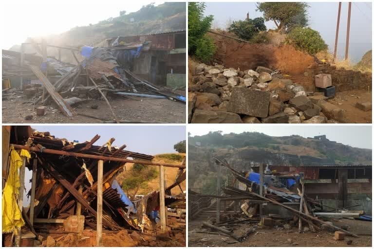
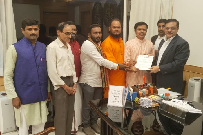
The formation of a district-level committee to address encroachments on forts in Kolhapur should have marked the beginning of decisive heritage protection. Instead, the timing of the decision became part of the controversy. According to the account under examination, the Kolhapur district administration constituted the committee approximately six months after the Maharashtra government directed districts to identify and remove encroachments from protected and unprotected forts. Hindu Janajagruti Samiti (HJS) consequently welcomed the creation of an institutional mechanism while questioning why it had taken so long and why experienced fort-conservation groups had received only limited representation.
The concern extends beyond an administrative delay. Maharashtra’s forts are archives built into stone, soil and landscape. They preserve military architecture, water-management systems, gateways, temples, memorials, settlements, trade routes and memories associated with Chhatrapati Shivaji Maharaj and the wider history of the Maratha polity. For families who visit Panhala, Vishalgad or other forts in Kolhapur district, deteriorating walls and unauthorized construction are not abstract planning failures. They can feel like the gradual loss of a shared inheritance.
The state directive and its original deadlines
Maharashtra’s Tourism and Cultural Affairs Department issued a Government Resolution on 20 January 2025 establishing district-level committees under the chairmanship of district collectors. The resolution recorded that Maharashtra then had 47 centrally protected forts under the Archaeological Survey of India and 62 state-protected forts under the Directorate of Archaeology and Museums. It also acknowledged encroachments at centrally protected, state-protected and unprotected forts. The official document is available through the Directorate of Archaeology and Museums’ Government Resolutions repository.
The timetable was unusually specific. Each district committee was expected to review the forts within its jurisdiction, prepare a fort-wise list of encroachments and submit it to the state by 31 January 2025. The period from 1 February to 31 May 2025 was designated for time-bound removal work. Committees were also directed to meet every month, submit monthly progress reports and prevent fresh occupation after clearance. These were operational obligations, not merely statements of intent.
If the reported six-month delay in Kolhapur is measured from the January resolution, the district’s coordinating body was established only after the original inventory and clearance deadlines had passed. That sequence explains the intensity of HJS’s criticism. A committee formed after the principal implementation window has closed begins its work with a credibility deficit, even if individual departments have undertaken separate surveys, notices or enforcement actions in the interim.

The episode exposes a recurring distinction in public administration: announcing a policy is not the same as creating the capacity to execute it. A government resolution can identify responsible offices and prescribe deadlines, but results still depend on district orders, verified land records, archaeological surveys, legal notices, police planning, conservation expertise, budget allocation and continuous monitoring. Failure at any one of these stages can stall the entire process.
Why Kolhapur’s forts require coordinated protection
Kolhapur district contains a dense and historically significant network of fortified sites, including Panhala, Vishalgad, Pavangad, Bhudargad, Samangad, Rangana and Pargad. Their ownership, legal status, terrain and present-day use are not uniform. Some fall under central or state archaeological protection, while others involve revenue, forest, municipal, village or private land. A structure that appears to be an encroachment on the ground may therefore require records from several agencies before its legal status can be determined.
These forts should not be understood as isolated masonry monuments. Their defensive value historically depended on slopes, escarpments, forests, water sources, access routes, lookout points and visual connections with other forts. Unauthorized development can damage this wider military landscape even when it does not physically touch a surviving wall. Excavation may disturb archaeological deposits; altered drainage may weaken foundations; new utilities may cut through historic fabric; and poorly located construction may obscure sightlines that help explain how the fort functioned.
The international significance of this landscape became even clearer in 2025, when UNESCO inscribed the Maratha Military Landscapes of India on the World Heritage List. The serial property comprises 12 fortifications, including Panhala Fort in Kolhapur district. UNESCO describes the network as an innovative defence system that integrated terrain, architecture and military planning. Its decision also emphasizes regular maintenance, stronger management of buffer zones and advance assessment of major projects that could affect the property’s outstanding universal value. These obligations are detailed in the UNESCO World Heritage Committee decision.
World Heritage recognition does not automatically repair a monument or remove an unauthorized building. It raises the standard by which management is evaluated. For Panhala in particular, local enforcement, visitor management and development control now form part of a wider responsibility to protect a site recognized as having value beyond district and state boundaries.
What counts as an encroachment?
The term “encroachment” is often used as though it describes one easily identifiable category. In practice, it can cover recently erected commercial stalls, extensions to existing buildings, houses constructed without permission, religious or community structures, roads, parking areas, utility lines, fencing, cultivation, dumping grounds and tourism facilities built beyond sanctioned limits. Some cases are recent and well documented. Others involve decades of occupation, disputed boundaries, incomplete land records or pending litigation.
A credible committee must therefore distinguish physical occupation from legal determination. A survey may identify a structure within a protected area, but removal ordinarily requires verification of the site boundary, ownership or custodianship, applicable permissions, date and nature of construction, statutory notices, responses from affected parties and any judicial orders. Treating every case as identical may produce rapid headlines while creating avoidable legal and social conflict.
The legal framework is divided between national and state protection. Monuments of national importance are governed by the Ancient Monuments and Archaeological Sites and Remains Act, 1958 and associated rules. State-protected monuments and archaeological areas are governed principally by the Maharashtra Ancient Monuments and Archaeological Sites and Remains Act, 1960 and the 1962 Rules. The Maharashtra Act published by India Code authorizes restrictions on construction and other activities within protected areas.

Section 21 of the Maharashtra Act is especially relevant. It restricts construction, mining, quarrying, excavation, blasting and similar activity in a protected area without state permission. It also enables the state to order the removal of a building erected in violation of that restriction and permits the Collector to carry out removal when the responsible person fails to comply, with costs recoverable from that person. These powers are substantial, but they must be exercised through documented and legally defensible procedures.
Due process is part of conservation
Speed and due process are sometimes presented as competing goals, but careful preparation usually makes lawful action faster. Accurate maps, complete files and reasoned orders reduce the likelihood of successful legal challenges. A defensible process should identify the competent authority, disclose the basis of the allegation, allow relevant documents to be produced, decide objections through a speaking order and respect any appellate or judicial directions.
Vishalgad illustrates the complexity. In February 2025, the Kolhapur Collector reportedly stated that some structures had already been removed while disputes concerning others were before the Bombay High Court and required hearings by the archaeology department. The administration said further action would be taken case by case in accordance with the court’s directions. That account, reported by The Times of India, demonstrates why a district committee must combine urgency with legal precision.
Enforcement must also remain neutral. The legality and heritage impact of a structure should be assessed by the same published criteria regardless of the religion, caste, political affiliation or economic position of its occupants or users. Lawful places of worship, memorials and community practices deserve protection, while unauthorized construction should be addressed through the applicable law. This equal standard is essential to preserve social harmony and prevent heritage conservation from becoming a pretext for collective blame.
Why representation became a central issue
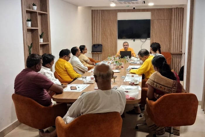
HJS’s second objection concerned the limited role given to fort-conservation organizations. The January 2025 Government Resolution created an official committee comprising the Collector and representatives of the police, Zilla Parishad, municipal bodies, forest department, Archaeological Survey of India, state archaeology directorate, maritime board where relevant and the resident deputy collector. It did not reserve seats for independent conservation architects, archaeologists, historians, structural engineers, traditional craftspeople or volunteer groups with long experience at particular forts.
Administrative authority is indispensable, but it does not replace field expertise. Officials may determine jurisdiction, issue notices, provide security and authorize expenditure. Conservation specialists can identify original masonry, later additions, vulnerable archaeological deposits, historic water channels and interventions that may cause irreversible damage. Local fort groups often possess dated photographs, route knowledge, oral histories and records of gradual changes that are unavailable in departmental files.
Representation should nevertheless be based on competence and transparent criteria rather than organizational visibility alone. Relevant qualifications could include documented conservation work, knowledge of archaeological law, familiarity with the district’s forts, absence of conflicts of interest and a commitment to nonviolent, evidence-based action. Gender diversity and participation by local communities would further broaden the committee’s understanding of how heritage policy affects visitors, residents and livelihoods.
Independent members should have access to agendas, survey records and minutes rather than serving as symbolic invitees. Their dissenting technical opinions should be recorded. At the same time, statutory decisions must remain with the legally competent authority. This arrangement would combine democratic participation with clear responsibility instead of allowing either officials or activists to disown difficult outcomes.
A technical roadmap for credible action
The committee’s first task should be a verified district inventory. Every fort should receive a unique file containing its protection status, custodian, survey and cadastral numbers, notified boundary, buffer or regulated zones, current land use, known archaeological features, access routes and pending cases. Existing records from revenue, forest, archaeology, municipal and village authorities should be reconciled instead of maintained as separate and sometimes contradictory lists.
A baseline condition survey should then combine dated ground photography with total-station measurements, satellite or drone imagery where permitted, photogrammetry and geographic information system mapping. Each suspected encroachment should be assigned coordinates and linked to photographs, dimensions, material, apparent use, estimated period of construction and the department claiming jurisdiction. Sensitive personal information should remain protected, but the spatial evidence must be detailed enough to withstand administrative and judicial scrutiny.
Cases should be classified by urgency and complexity. Recent construction threatening a wall, water system or archaeological deposit requires immediate preventive action. Vacant unauthorized structures may permit comparatively straightforward proceedings. Occupied buildings with long histories, disputed titles or pending cases need a separate legal track. Visitor facilities, shops and utilities may require relocation or redesign rather than an improvised demolition that leaves the same demand unresolved.
A public risk matrix would help prioritize work. Structural danger, archaeological sensitivity, environmental impact, date of construction, legal clarity, public-safety implications and probability of further expansion could each be scored. Such a system would make it harder for politically prominent cases to consume all available resources while less visible but more destructive activity continues elsewhere.

Evidence management is equally important. Survey sheets should be signed, images time-stamped, land extracts certified and inspection teams identified. Changes after the baseline survey should be logged. A reliable chain of documentation protects both the administration and affected parties by reducing disputes over what existed, when it appeared and which authority recorded it.
The legal stage should proceed through standardized notices, a fixed period for replies, scheduled hearings and reasoned decisions. Files affected by court orders should be placed on a dedicated litigation tracker. The committee should identify which agency must act next, the deadline for that action and the officer responsible. “Matter pending” should never become an indefinite administrative category when a specific procedural step remains available.
Before physical removal begins, conservation professionals should document adjacent historic fabric and prepare a method statement. Machinery, vibration, temporary access and debris movement can damage fragile masonry even when the unauthorized structure itself has no heritage value. Where necessary, walls should be shored, archaeological observation arranged and utilities safely disconnected. Demolition debris must be removed through designated routes rather than dumped on slopes, in cisterns or beside fortification walls.
The human dimension also requires advance planning. Occupants may include recent commercial operators, long-settled families, tenants who did not create the original violation or people who may qualify for rehabilitation under another policy. The committee should not presume eligibility, but it should direct each case to the competent authority for a documented decision. Heritage protection is strengthened, not weakened, when enforcement is firm, humane and legally consistent.
Preventing the next encroachment

Removal without prevention creates a cycle of expenditure and conflict. Once an area is cleared, boundary markers, mapped protection zones and visible information boards should explain what activity is prohibited and which office grants permission. Local officials need a shared permit register so that a building approval from one department cannot be used to bypass archaeological or forest restrictions imposed by another.
Regular photographic monitoring can detect change before a foundation becomes a permanent building. High-risk locations near roads, entrances, water sources and tourism nodes require more frequent inspection. A public reporting channel should accept geotagged photographs and issue a trackable complaint number, while safeguards should discourage harassment, duplicate complaints and the public disclosure of personal data.
A district heritage dashboard could publish the number of forts surveyed, suspected encroachments verified, notices issued, hearings completed, structures removed, cases stayed by courts and sites secured against recurrence. It should also publish meeting dates, non-sensitive minutes and expenditure. Progress expressed only as a percentage can conceal inactivity; fort-wise and case-wise information permits meaningful public scrutiny.
Accountability should be attached to named offices and deadlines. When a milestone is missed, the monthly or quarterly report should record the reason, corrective action and revised date. Delays caused by litigation, monsoon conditions or technical risk are different from delays caused by an unsigned file or an unheld meeting. Transparent reporting makes that distinction visible.
Encroachment removal is only one part of conservation

A cleared fort can still deteriorate through blocked drainage, invasive vegetation, weathered mortar, uncontrolled footfall, litter, fire, vandalism and incompatible repairs. The district plan should therefore connect enforcement with a conservation-management plan for each major fort. Priorities should include monsoon drainage, structural stabilization, vegetation control, water-system protection, fire safety, waste management and interpretation for visitors.
Repairs must follow material and structural studies. Hard cement pointing, aggressive cleaning or conjectural reconstruction can accelerate decay and erase evidence. Compatible lime-based materials should be used where analysis of the original fabric supports them, and new work should remain distinguishable on close inspection without disrupting the monument’s character. Every intervention should be photographed and archived for future conservators.
Tourism requires similar discipline. Parking, toilets, food stalls, lighting and safety barriers may be necessary, but necessity does not justify arbitrary placement. Facilities should be located through carrying-capacity studies and heritage-impact assessment, using reversible designs where possible. Vendors can be organized in designated areas with waste and wastewater controls, protecting livelihoods while preventing incremental occupation of sensitive land.
Local schools, colleges, historians and volunteer organizations can support documentation, guided walks, cleanliness campaigns and monitoring under professional supervision. Citizen participation should complement trained conservation and statutory enforcement rather than substitute for them. The state remains responsible for maintaining records, deciding legal status, funding essential work and preventing vigilantism.
The policy framework subsequently evolved

On 27 January 2026, Maharashtra issued a revised Government Resolution that superseded the January 2025 framework and expanded the system to include state-protected monuments as well as forts. Significantly, the revised district committee provides for four non-government members drawn from persons or voluntary organizations working in the study, protection and conservation of forts or protected monuments. It also creates a state-level committee with four expert or voluntary-organization invitees. An English translation of the revised framework records these provisions in detail in the 27 January 2026 Government Resolution.
The revised policy requires district committees to meet at least once every three months, report through the Director of Archaeology and Museums, monitor recurring encroachments and coordinate with the department possessing the land. It also addresses pending judicial or quasi-judicial proceedings, prompt disposal of demolition waste and the use of District Planning and Development funds for debris removal. These provisions answer several practical weaknesses revealed during the first phase of implementation.
The later inclusion of non-government members partly validates the concern that official committees benefit from independent conservation knowledge. It does not, by itself, guarantee meaningful participation. District collectors must select members transparently, fill the positions promptly and provide them with access to the information necessary to contribute. A vacant expert seat is functionally no different from an omitted one.
From committee formation to measurable protection
HJS’s demand for swifter action should ultimately be assessed through measurable outcomes rather than the volume of official correspondence. The essential questions are straightforward: Has every fort in Kolhapur district been surveyed? Is there a verified, legally classified list of encroachments? Have notices and hearings been completed? Are court-affected cases actively tracked? Has vulnerable historic fabric been stabilized? Are cleared areas being monitored against renewed occupation?
The strongest response to criticism would be a published action plan with fort-wise milestones, responsible officers, expert participation and regular progress reports. Where removal cannot proceed immediately, the administration should state the precise legal or technical obstacle and the next authorized step. Silence creates suspicion; evidence-based reporting creates confidence even when a difficult case requires time.
Kolhapur’s forts belong to a historical landscape whose meaning reaches far beyond present-day political divisions. Their protection should unite public authorities, scholars, local communities and heritage organizations around lawful and non-sectarian stewardship. Hindu, Buddhist, Jain and Sikh traditions all affirm, in distinct ways, the value of memory, sacred geography, disciplined service and responsibility toward inherited places. That shared ethic is best expressed through conservation that respects evidence, human dignity and equal application of the law.
The district committee is therefore a necessary beginning, but it cannot be treated as the achievement itself. Its legitimacy will depend on whether delayed administration gives way to verified surveys, fair hearings, technically safe enforcement, transparent expert participation and long-term maintenance. Maharashtra’s forts have survived warfare, political transition and centuries of monsoon weather. Their future should not be endangered by preventable administrative drift.
Inspired by this post on Hindu Jagruti Samiti.







Leave a Reply
You must be logged in to post a comment.