
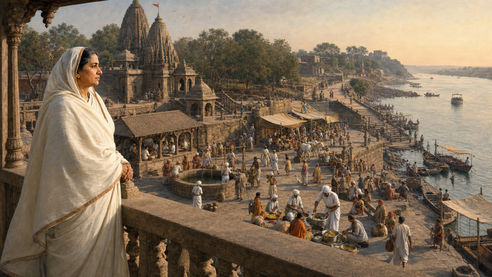
You may know Ahilyabai Holkar as the queen who rebuilt temples. But if you want to understand why her work still matters, counting temples is the wrong place to stop. Look instead at what made a sacred place reachable, usable and capable of supporting a community.
Her distinctive achievement was to treat sacred geography as a public system. Temples were joined to ghats, wells, roads, rest houses, food provision, markets and secure travel corridors. Once you see those connections, her projects in Maheshwar, Kashi, Somnath and other pilgrimage centres no longer look like scattered acts of royal charity. They form a coherent model of Dharmic statecraft.
Read the sacred map as a network, not a monument list
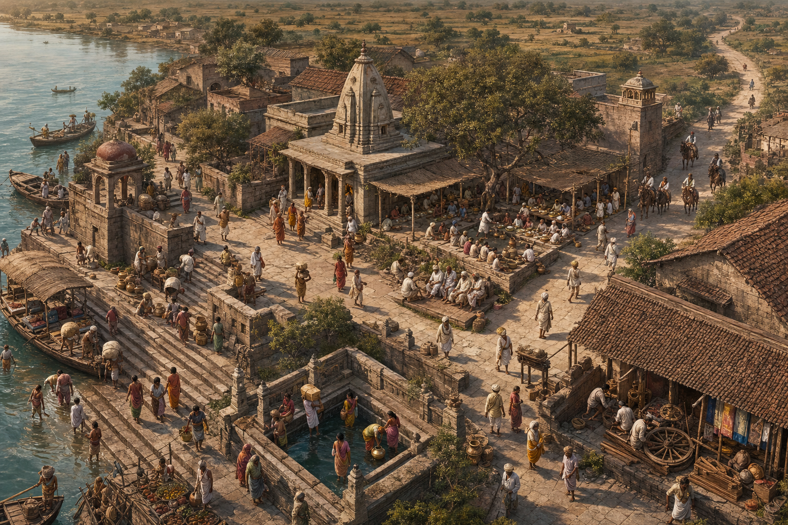
A temple can remain standing while the living pilgrimage around it weakens. A damaged ghat can make a river difficult to approach. An unsafe road can isolate a shrine. The absence of water, shelter or food can place a yatra beyond the reach of ordinary families. Sacred geography therefore depends on more than consecrated architecture.
Ahilyabai’s programme can be read through four connected layers:
- The sacred centre: the temple, matha or established place of worship that gives the destination its religious meaning.
- The approach: roads, trade corridors and ghats that allow people to reach the site and enter it with dignity.
- The support system: wells, dharmashalas, caravanserais and anna-kutirs that provide water, rest and food.
- The local economy: cultivators, traders, craftspeople and markets that keep a pilgrimage town functioning beyond festival days.
This changes how you should interpret her legacy. The unit of achievement is not the temple alone; it is the temple together with the route, riverfront, shelter and livelihood network around it. A ruler who finances only the sanctum may preserve an object. A ruler who also supports access and hospitality helps preserve a practice.
The model was also capacious. Facilities endowed under her rule served Hindu, Buddhist, Jain and Sikh seekers and travelers. That does not erase the theological differences among these traditions. It shows how roads, water, shelter and public hospitality can become shared Dharmic ground while each path retains its own discipline and identity.
Four places reveal the design of her sacred geography

Maheshwar: the working model
Maheshwar on the Narmada was not merely Ahilyabai’s residence. After she took charge of the Holkar polity in 1767, it became the setting in which worship, administration, commerce and public works operated together. The riverside fort complex, ghats and Ahalyeshvara Mahadeva Temple express a late-Maratha architectural language, but their arrangement also shows how sacred and civic space could reinforce one another.
If you visit Maheshwar, do not keep your attention fixed on the temple facade. Turn toward the river access, then toward the fort and settlement, and finally toward the weaving economy. The weaving traditions later associated with Maheshwari sarees were supported by trade security and encouragement for artisanal guilds. The point is not that every activity was religious. It is that the sacred capital could sustain devotion because its civic and economic parts were allowed to function together.
Kashi: restoration at a civilizational centre
Ahilyabai rebuilt the Kashi Vishwanath Temple in 1780. She did not create Kashi’s sacred meaning; her intervention restored material capacity at an already revered centre. That distinction matters. Her role was not to manufacture sanctity through royal authority, but to place royal resources in the service of an inherited tirtha.
Ahilyabai Ghat near Kashi Vishwanath helps you read the project beyond the shrine. Temple and riverfront belong to the same pilgrim experience: darshan, movement, bathing, rest and onward travel occur within one urban sacred landscape. When you study Kashi, ask what connects the sanctum to the river and who maintains that connection. This question reveals more than a list of royal donations.
Somnath: reconstruction as continuity
Her reconstruction at Somnath in Prabhas Patan followed in 1783. The civic meaning of such work lies in continuity. A damaged or diminished sacred centre does not return to life merely because its past is remembered. Worship needs a functioning place, and pilgrims need practical means of reaching and using it.
This is why restoration should not be mistaken for nostalgia. Ahilyabai’s approach joined memory to renewed use. For a sacred site, the decisive question is not simply whether old stones survive. It is whether people can once again practise, gather, serve and transmit the place’s meaning.
The wider circuit: Gaya, Dwarka and the routes between regions
Facilities connected with her patronage extended through pilgrimage circuits that included Gaya and Dwarka as well as Kashi and Somnath. Within and around the Holkar domain, roads and market facilities connected Maheshwar, Indore and Ujjain with commercial centres toward the Deccan and Rajputana.
The geographic spread prevents a common misreading. Ahilyabai was a sovereign rooted in Malwa, but her Dharmic responsibility was not confined to monuments inside her capital. She treated distant sacred centres as part of a larger civilizational inheritance. The resulting map joined locality with Bharatavarsha: firm roots in one region, service extending across many regions.
The temple programme rested on justice and a civic economy
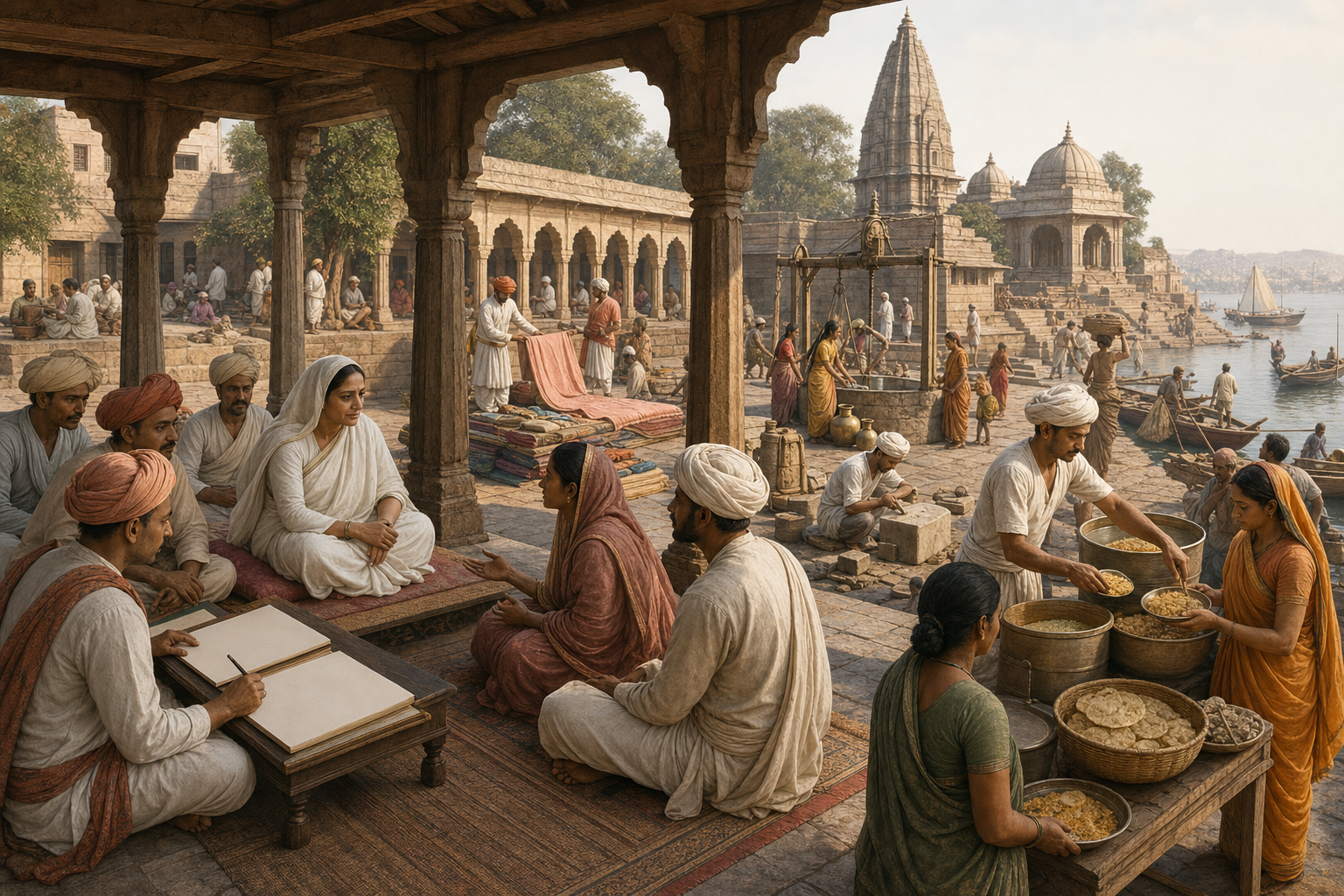
Ahilyabai’s reputation for nyaya, daan and maryada is easiest to understand through institutions rather than praise alone. Her regular darbar offered access to justice. Careful land-revenue assessment sought to protect cultivators. Wells, irrigation and drought relief supported agrarian life. Roads, sarais and market facilities made movement and exchange more dependable.
The chronology matters
Her public authority developed through responsibility before it became visible through major temple reconstruction. After her husband Khanderao Holkar fell at Kumbher in 1754, she declined sati with the support of Malhar Rao Holkar and progressively assumed administrative duties. Malhar Rao died in 1766, and she took charge in 1767. The Kashi and Somnath works came in the 1780s, more than a decade into her sovereign rule.
That sequence guards against a shallow portrait of a pious queen who simply donated buildings. The major restorations belonged to a mature system of rule. Revenue policy, public access, commercial movement and sacred patronage were different responsibilities, but they supported the same social order.
How the system served different people
| Person | Public provision | Practical effect |
|---|---|---|
| Resident or petitioner | Regular darbar and direct access to justice | Gave grievances a route toward redress |
| Cultivator | Careful revenue assessment, irrigation and drought relief | Protected the agrarian base on which towns and institutions depended |
| Traveler or trader | Roads, caravanserais and market facilities | Supported safer movement, rest and exchange |
| Pilgrim | Temples, ghats, wells, dharmashalas and anna-kutirs | Made worship, water, food and shelter part of one journey |
| Artisan | Secure trade corridors and encouragement for guilds | Connected cultural patronage with durable employment |
The mechanism is straightforward. Productive agriculture supports stable settlements. Secure routes help both traders and pilgrims. Markets create livelihoods around sacred towns. Artisans give those towns a distinctive material culture. Temples and public hospitality attract continued participation. Each part strengthens the others.
You can use this system as a test for present-day heritage work. Before calling a project a renewal, ask:
- Can people reach the sacred site safely and approach its essential spaces?
- Where can travelers find water, food and rest?
- Do local artisans and service communities gain a continuing livelihood, or only temporary ceremonial attention?
- Who remains responsible for the ghat, well, shelter or route after the inauguration?
- Can affected residents obtain timely redress when administration fails?
A polished facade with an unusable ghat or neglected approach is not full renewal by this standard. The public system around the shrine is part of its living heritage.
A practical way to visit or teach the Holkar map
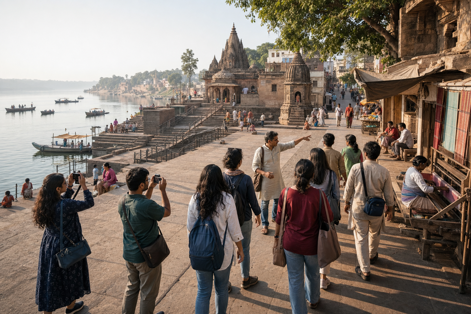
You do not need to complete a pan-Indian pilgrimage to understand Ahilyabai’s method. A visit to one site, or even a careful map exercise at home or in a classroom, can reveal the design if you ask disciplined questions.
- Put Maheshwar at the interpretive centre. Mark the Narmada, fort, ghats, Ahalyeshvara Mahadeva Temple and weaving tradition. Note how rule, worship, river access and livelihoods occupied one civic landscape.
- Add the regional network. Mark Indore and Ujjain, then show the broader commercial directions toward the Deccan and Rajputana. Do not reduce these connections to a single literal road unless you have route-specific evidence.
- Add the distant sacred centres. Mark Kashi, Gaya, Dwarka and Somnath. Use a different colour from the commercial connections so that pilgrimage destinations and trade directions remain analytically distinct.
- Read each place in layers. Look for the sacred centre, approach, water access, shelter, food provision, market and craft economy. Record what survives, what has changed and what still performs its intended function.
- Separate attribution from atmosphere. Do not label an entire present-day precinct as eighteenth-century merely because Ahilyabai funded one element within it. Distinguish a directly attributed project, wider Holkar patronage and later additions.
- Ask who could use the provision. A public well, road or rest house may have served a wider range of travelers than a temple’s ritual community. This is where the inclusive civic dimension of her Dharmic vision becomes visible.
- Finish with stewardship. Identify one neglected support function rather than ending with admiration. It might be authorized ghat cleaning, annadanam, conservation support, women’s education or direct support for a traditional artisan initiative.
This method also helps when teaching children. Instead of asking them to memorize a catalogue of buildings, ask them to design the support system for a pilgrim traveling between two marked places. Where will the traveler find water? Where will the family rest? Which craft community earns a livelihood? Who repairs the road? The answers turn Ahilyabai’s history from royal biography into a lesson in responsible governance.
If you visit Maheshwar, Kashi or Somnath, keep a simple two-column note. In the first column, record what supports darshan directly. In the second, record what supports the people who make darshan possible: priests, travelers, craftspeople, traders, cultivators and caretakers. The second column is often where her full achievement comes into view.
Key takeaways
- Ahilyabai Holkar’s legacy is best understood as a network of temples, routes, ghats, waterworks, shelter, food provision and livelihoods.
- Maheshwar shows the model at the scale of a capital; Kashi and Somnath show its extension to major sacred centres beyond Malwa.
- Her temple restorations rested on an established administrative programme of accessible justice, prudent revenue policy, public works and commercial security.
- Shared infrastructure could serve Hindu, Buddhist, Jain and Sikh travelers without erasing the distinctions among their traditions.
- A faithful commemoration should preserve use as well as appearance: access, hospitality, craft livelihoods and long-term care all matter.
Ahilyabai Holkar Jayanti falls on 31 May 2026. If you plan to observe it, choose one bounded act before that date: support annadanam, join an authorized cleanliness effort, contribute to responsible heritage conservation, help a women’s education initiative or buy directly from a traditional artisan. Give the action a named steward and a follow-up date. That brings remembrance closer to her own standard: devotion made durable through public responsibility.