

If you have noticed a new wall, shed, shopfront, or extension near Panhala Fort, your first decision is not whether to campaign for demolition. It is whether you can turn that concern into a verifiable case without trespassing, confrontation, or public accusation.
The credible path is straightforward: document what is visible, establish the legal boundary, verify permissions, insist on notice and hearing, track the resulting order, and keep monitoring after action is taken. That sequence gives you something more useful than outrage: an administrative record that cannot easily be ignored.
Start with evidence that officials can verify
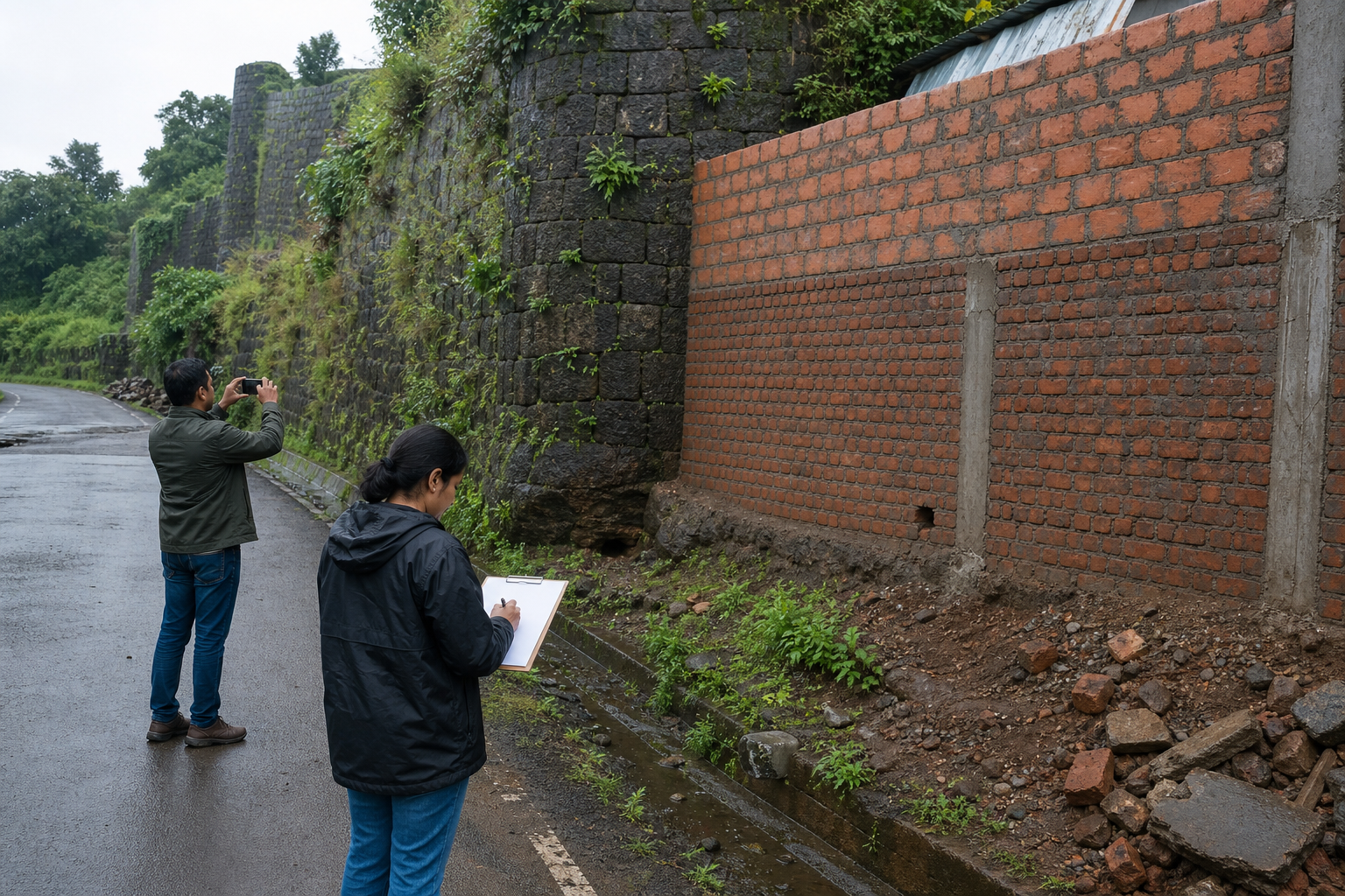
In a citizen complaint, “illegal encroachment” is a conclusion. What you personally possess is an observation. A structure may look new or intrusive without necessarily being inside a protected boundary, and only the relevant map, land record, and permission file can establish its legal status. Report suspected unauthorized work, therefore, rather than declaring a person guilty.
Create one evidence packet for each location. Keep it factual and include:
- The exact location, using a map pin and the nearest identifiable fort feature or public path.
- The date and time you observed the structure or activity. If you do not know when work began, do not guess.
- A neutral physical description: approximate form, visible materials, whether work appeared active, and whether it seemed to touch historic fabric.
- One wide photograph showing the setting and one closer view showing the observed change, both taken from a place where you may lawfully stand.
- Any visible effect on access, a gateway, rampart, historic surface, or vista. Record only what the image supports.
- Your name and contact details for acknowledgment, while requesting that personal information not be published unnecessarily.
Preserve the original photographs. Do not crop away the surroundings, overwrite the files, enter private property, climb fort walls, move building material, or provoke the occupants. Those actions can create safety and legal problems while weakening the credibility of your complaint.
A useful subject line is: “Request for inspection and status disclosure concerning suspected unauthorized construction near Panhala Fort.” In the body, ask for five identifiable outputs: an acknowledgment or case number, an inspection, boundary verification, the permission status, and a written outcome.
Send the same packet to the Archaeological Survey of India and the Kolhapur district administration, copying the relevant local body where possible. Panhala’s protection has been weakened by unclear coordination among heritage authorities, local administration, and law enforcement. A common evidence packet makes it harder for one office to dismiss the matter merely by pointing to another department. Retain every acknowledgment, forwarding note, and reply.
Demand a boundary map before demanding removal
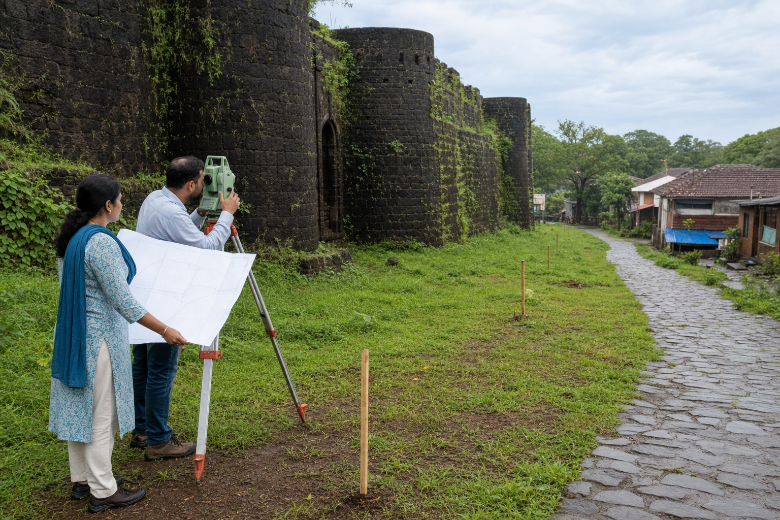
The first institutional victory is not demolition. It is an authoritative, publicly accessible boundary. Without one, residents cannot reliably know where restrictions apply, officials can enforce rules inconsistently, and every disputed structure becomes a fresh argument about jurisdiction.
Ask for an ASI-led survey and demarcation of the protected and regulated zones. A credible demarcation exercise should produce more than an internal file. Citizens should be able to identify:
- A dated map showing the relevant boundaries.
- Ground markers or other visible boundary indicators where they are feasible and conservation-safe.
- An inventory of structures examined, with each one marked as authorized, under verification, or determined to be unauthorized.
- The agency responsible for each next action rather than a vague reference to “the authorities.”
- A public timetable covering inspection, verification, notice, decision, any removal or remedial work, and follow-up monitoring.
Frame follow-up questions so that an office must answer with a fact or a record. Has the survey been ordered? Which office is leading it? What document identifies the boundary? Has the structure been inspected? Is a permission file available? What is the next recorded step? Questions such as “What are you doing about encroachment?” invite general assurances; document-based questions reveal whether the process is actually moving.
If one agency redirects you, ask it to identify the receiving office and retain the forwarding reference. Administrative coordination should be visible to the public. A resident should not have to reconstruct the division of responsibility among ASI, the district administration, the local body, and police merely to discover whether a complaint reached the correct desk.
Lawful enforcement protects both the fort and the case
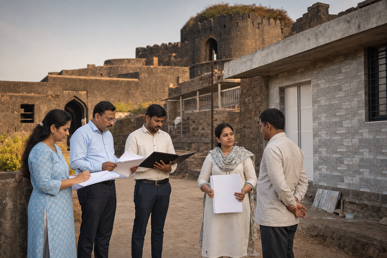
The legal framework restricts unauthorized construction within specified monument zones, while UNESCO-linked conservation responsibilities call for active protection, management, and monitoring. Neither principle makes every nearby structure automatically illegal. The boundary, approval record, physical inspection, and applicable order must be checked in each case.
A defensible enforcement process should move through an auditable sequence:
- Confirm the protected or regulated boundary and the relevant jurisdiction.
- Inspect and photograph the location while documenting the condition of nearby historic fabric.
- Check land, construction, and heritage-permission records.
- Notify the affected party and provide the legally required opportunity to respond.
- Issue a reasoned decision that identifies the authority, evidence, and required action.
- Carry out removal or other lawful remediation under conservation supervision when unauthorized work is established.
- Inspect the site again, record its condition, and publish the closure status.
Due process is not a concession to encroachment. It distinguishes enforceable heritage protection from arbitrary action. Notice and hearing reduce the risk that a lawful structure is removed, that residents are denied their rights, or that a valid protection order later becomes harder to defend.
Do not participate in self-help demolition or pressure officials to bypass these steps. Unsupervised removal beside historic masonry could damage the monument, injure people, destroy useful evidence, and complicate lawful proceedings. “Time-bound” should mean published milestones and accountable officers, not action without verification.
Conservation safeguards matter during removal as much as during construction. Before machinery or manual dismantling begins near historic fabric, citizens can ask whether ASI has reviewed the method, whether the monument’s existing condition has been recorded, and who will inspect it afterward. Clearing an unauthorized addition while damaging the fort would not be a preservation success.
Build a monitoring system that outlasts one controversy
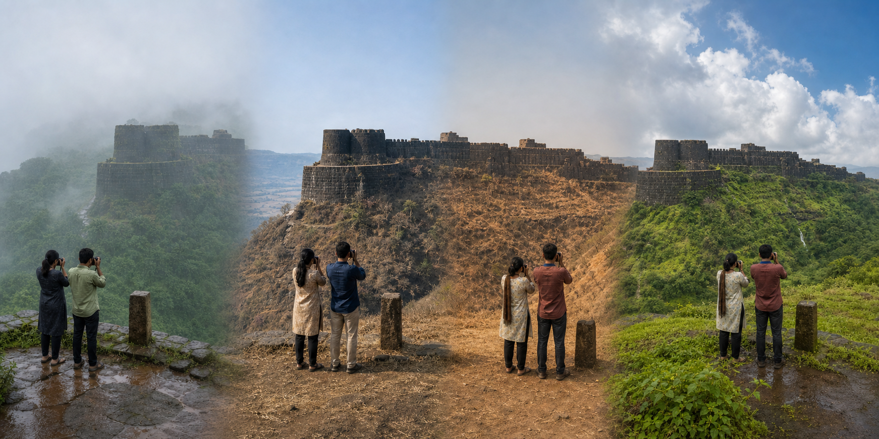
Removing one structure will not protect Panhala if the next change remains unnoticed until it is difficult to reverse. The durable answer is a baseline that can be compared with later conditions. Authorities should be pressed to establish mapping, geofencing, a public reporting channel, coordinated response procedures, and published independent audits.
A practical monitoring system would combine:
- Fixed photographic viewpoints for sensitive gateways, ramparts, approaches, and vistas.
- A dated geospatial inventory against which later physical changes can be checked.
- Government-authorized drone surveys where appropriate and lawfully permitted. Visitors should not improvise drone flights around the fort.
- A grievance portal or hotline that issues a case number and records changes in status.
- A response procedure stating which office inspects, who verifies permissions, and when unresolved cases escalate.
- Periodic third-party audits whose findings and follow-up actions are published.
Citizens can strengthen this system without pretending to be enforcement officers. A local group can walk the same lawful public route at a fixed interval, photograph the same viewpoints, and submit only observable changes. Schools can use heritage walks to teach students how to notice damage without touching the monument. Faith and community organizations can help residents understand the boundary and the reporting process. A public case tracker can record reference numbers, dates, agency responses, and outcomes without publishing unverified accusations against individuals.
This is where Dharmic stewardship becomes concrete. Hindus, Buddhists, Jains, and Sikhs do not need identical historical interpretations to cooperate in caring for inherited places. Truthfulness in reporting, non-harm, lawful conduct, and service to future generations provide a shared discipline. Panhala’s ramparts, gateways, and vistas carry civilizational memory only if the physical place survives with its integrity intact.
Keep that stewardship separate from vigilantism. Do not surround homes, identify families online, circulate names without verified records, or turn a boundary dispute into communal hostility. The goal is shared custodianship: protect the monument, respect citizens’ rights, and require public agencies to perform the duties entrusted to them.
Key takeaways
- Report a suspected violation as an observation, not a verdict, and support it with a precise location, date, neutral description, and original photographs.
- Ask first for an ASI-led boundary survey and a public map. Enforcement cannot be consistent while the applicable zones remain unclear to residents.
- Track milestones: inspection, permission verification, notice, hearing, decision, conservation-safe action, and re-inspection.
- Insist on due process. It protects residents while making legitimate heritage orders more credible and durable.
- Convert one complaint into continuing stewardship through fixed-view monitoring, case numbers, public status updates, heritage walks, and independent audits.
Choose one useful action now: assemble a factual evidence packet, request the demarcation map, or bring a community group together to learn the reporting process. Panhala will be safer when each public concern becomes a traceable case, each case reaches a lawful outcome, and each outcome is checked against a visible record.
References
