
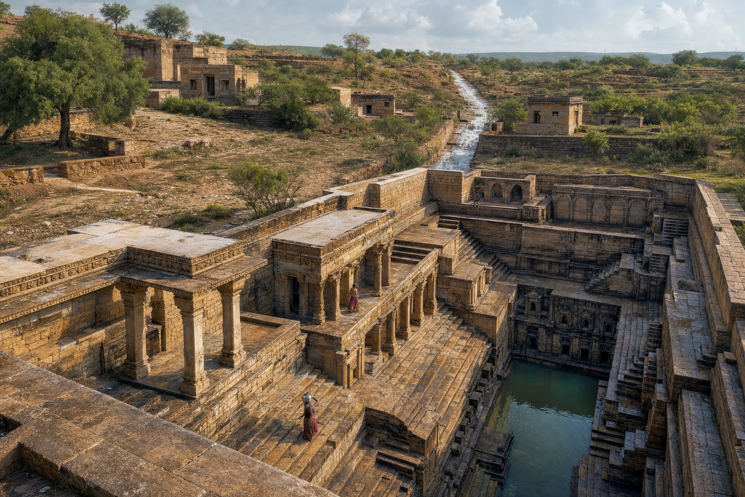
You may admire a stepwell’s carvings and still miss its most important achievement. If you want to know whether this inherited architecture offers a practical lesson for heat, water scarcity, or urban design, follow the rain before you follow the ornament.
A working stepwell joined catchment, filtration, groundwater, shade, structure, access, and maintenance. That joined-up thinking is the lesson worth recovering. Copying the staircase alone produces a visual quotation; understanding the whole system gives you a climate strategy.
Read the stepwell as a water system, not an isolated pit
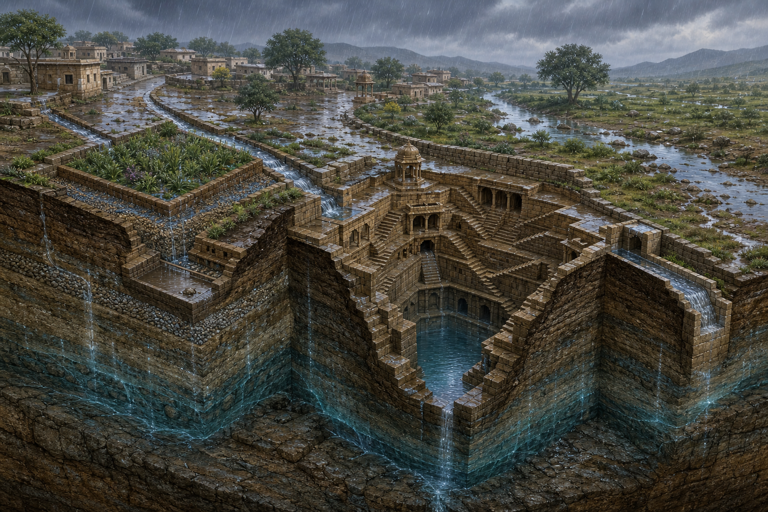
The visible descent is only the final part of the machine. A stepwell typically brings people down toward a masonry-lined shaft connected to a shallow aquifer. During the monsoon, runoff moves from a surrounding catchment through inlets and settling or filtering elements before reaching storage and the ground below. Gravel, lime, silt traps, and percolation through soil and stone can reduce suspended material, while periodic desilting keeps the route open. The broad stepped surfaces increase contact between water and masonry, supporting infiltration and local groundwater recharge.
You can reconstruct that logic at a surviving site by tracing five things in order:
- Find the catchment. Identify the roofs, streets, courtyards, slopes, or channels from which rain could have arrived.
- Follow the inlet. Look for channels, changes in level, settling chambers, or places where sediment would slow before entering the main structure.
- Locate the recharge and storage zone. Ask whether the structure merely held surface water or also communicated with an aquifer through its shaft and permeable surroundings.
- Track the seasonal path of the user. Lower steps are not decorative repetition; they preserve access as the water level falls.
- Look for the maintenance route. If people cannot remove accumulated silt, inspect masonry, and control contaminated inflow, the hydraulic system cannot remain functional.
A simple water balance helps you test whether a proposed revival is plausible. Gross annual inflow is approximately rainfall multiplied by connected catchment area and a runoff coefficient. From that amount, you must subtract evaporation, water drawn by users, and seepage that does not contribute to the intended aquifer.
Consider the documented example of a 10,000-square-metre catchment receiving 600 millimetres of rain with a runoff coefficient of 0.30. The calculation is 0.6 metres x 10,000 square metres x 0.30, giving a gross monsoon inflow approaching 1,800 cubic metres. That is a planning estimate, not a promise of 1,800 cubic metres of usable drinking water. A disconnected drain, a silted inlet, polluted runoff, or unsuitable geology can change the result sharply.
This changes the first question you should ask about an old or proposed stepwell. Do not begin with, “How much can the basin hold?” Begin with, “What area actually feeds it, where does that water travel, and who keeps that path functioning?” Storage without a living catchment is an empty container.
One geometry manages water, heat, and earth pressure
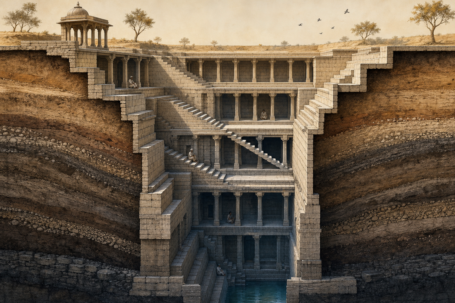
Why the descent becomes cooler
Stepwells do not cool space through one miraculous feature. Several modest effects reinforce one another. The depth reduces exposure to the hot sky. Narrow openings and stacked galleries keep direct sunlight away from lower levels. Massive stone absorbs heat slowly and moderates rapid temperature swings. Water supports evaporative cooling, while stairs, landings, pillars, and intermediate chambers interrupt strong air currents and encourage gentler movement through the space.
The combined effect can place interiors about 5 to 7 degrees Celsius below ambient summer highs. Treat that range as a characteristic of the described semi-arid examples, not as a universal performance guarantee. Orientation, water level, stone, humidity, depth, shade, and surrounding construction all matter.
When you visit, notice the transition rather than merely declaring the bottom “cool.” Compare sunlight, radiant heat, air movement, and perceived temperature at the entrance, an intermediate landing, and the lowest safely accessible level. The sequence tells you which parts of the geometry are doing useful climatic work. For a modern project, measurements at those same levels would be more informative than one temperature reading taken in the deepest chamber.
Why the walls, pillars, and landings matter
Excavating deeply creates a structural problem: the building must carry its own galleries while resisting soil pressing inward from both sides. Historic builders answered with thick retaining walls, closely spaced pillars, transverse beams, brackets, lintels, and corbelled stone courses. Landings could also brace the long descent. Dressed stone carried compression, while lime-based mortars and hydraulic plasters helped control water movement.
This is why an apparently small crack, displaced block, blocked drain, or tree root cannot be judged as a surface blemish. It may involve drainage, lateral earth pressure, or a change in the foundation environment. Any proposal to reopen a buried gallery, add water, increase visitor loads, or reconnect runoff needs structural and conservation assessment. A picturesque ruin is not automatically a safe public reservoir.
Use famous examples as diagnostic models
Different monuments make different parts of the system easy to see. Use them as models for asking questions, not as templates to copy indiscriminately:
- Rani ki Vav at Patan, built in the 11th century and measuring roughly 64 metres long by 20 metres wide, shows how a long, pavilion-like descent can unite hydraulic access, sacred movement, and a largely Vaishnava sculptural programme.
- Chand Baori at Abhaneri, dating to around the 9th century, uses approximately 3,500 steps to descend more than 20 metres. Its repeated flights make changing water levels accessible while giving the enclosure a regular structural rhythm.
- Adalaj ni Vav, from the late 15th century, brings filtered light and air through five storeys of galleries and an octagonal opening. It is especially useful for studying the balance between ventilation and solar exposure.
- The 15th-century stepped tank at Hampi is not a deep shafted vav, but its tiered access, channels, and ritual platforms reveal the same civilizational habit of making water infrastructure legible and reachable.
The comparison prevents a common mistake. A stepwell, a temple tank, and a deep baori may share stepped access without having identical hydrology. Before applying any lesson, determine whether you are looking at an aquifer-connected shaft, a surface tank, a ritual reservoir, or a combined system.
Dharma turned water engineering into a public obligation
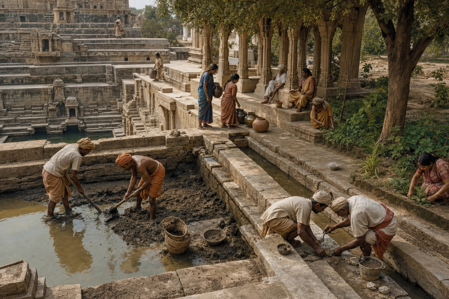
A stepwell was a public work before it became a protected monument. The ideal of udapana-dana, the gift of water, placed its construction within dharma: providing a life-sustaining resource was meritorious because it served people beyond the patron’s household. Water, shelter, and rest were joined in a single civic institution.
Patronage was correspondingly broad. Queens such as Udayamati at Rani ki Vav and Rudabai at Adalaj commissioned major works. Merchant communities endowed wells along trade routes. Temple and monastic institutions maintained tanks for ritual and daily use. Pillared landings could support travellers, local exchange, deliberation, and seasonal community work as well as the collection of water.
The tradition also crossed sectarian boundaries. Jain merchant networks financed vavs; Buddhist monastic centres such as Nalanda maintained stepped tanks; and the 16th-century Baoli Sahib at Goindwal, associated with Guru Amar Das, has 84 steps and remains bound to Sikh practice and pilgrimage. The shared form did not erase theological differences. It expressed a practical Dharmic compact: water is sacred, human beings depend on it together, and access carries reciprocal duties.
That ethical claim should not be reduced to attractive iconography. If you are interpreting or reviving a site, ask questions that reveal whether the public obligation still exists:
- Who can enter, and at what hours and seasons?
- Who inspects the inlets, removes silt, tests water, and repairs damaged masonry?
- Who decides how water is shared when the level falls?
- Can pilgrims, nearby residents, workers, and other users reach the space safely without excluding one another?
- Is the catchment protected as part of the monument, or is only the carved structure protected?
These questions also keep heritage interpretation honest. The ideal of shared water is important, but an ideal alone does not prove how access worked for every person at every site. Local inscriptions, physical barriers, community memory, and patterns of use should be examined rather than replaced with either romantic certainty or blanket dismissal.
A serious revival begins upstream of the monument
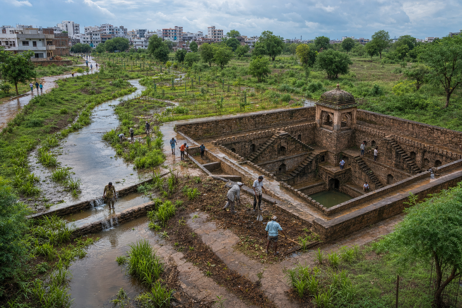
Restoring carvings while leaving the feeder drains severed preserves an object but not its intelligence. A climate-conscious revival must treat the catchment, water body, aquifer, shaded public space, and maintenance institution as one project.
- Map the historic and present catchment. Mark slopes, roofs, drains, paved surfaces, waste sites, sewage risks, and every point where water is diverted away. Do this before estimating storage.
- Define the intended water function. Groundwater recharge, landscape irrigation, emergency non-potable storage, ritual use, and drinking water do not have the same quality requirements. Never assume that clear-looking water is potable; use appropriate sampling, laboratory testing, and treatment.
- Assess soil, aquifer, and structure together. A hydrogeologist or water engineer can examine recharge behaviour, while structural and conservation specialists assess retaining walls, foundations, mortars, galleries, and safe loading. Reintroducing water can alter pressures and moisture paths.
- Reconnect clean runoff gradually. Permeable paving, bioswales, roof-water connections, and controlled channels can turn stormwater into recharge, but dirty road runoff should not simply be poured into a historic shaft. Include settling and filtration suited to the actual contaminants.
- Restore maintainability. Provide safe access to silt traps and inlets, define responsibility for cleaning before the monsoon, and inspect the system after major inflows. If maintenance depends on an unnamed future volunteer, it is not yet a management plan.
- Measure performance across seasons. Record rainfall entering the connected catchment, water levels, sediment accumulation, water-quality results, and temperatures at upper and lower landings. Publish the method with the result so that a cool afternoon or one successful monsoon is not mistaken for permanent performance.
The best modern adaptation may not resemble a historic monument in every detail. A neighbourhood park could combine a sunken shaded court with a recharge basin, permeable paving, planted runoff channels, and roof-water collection. What makes it faithful is not carved stone or a dramatic staircase. Fidelity lies in the relationship among seasonal water, gravity, shade, access, repair, and public duty.
There are also clear limits. A stepwell cannot compensate for a polluted catchment, unlimited groundwater extraction, unsafe retaining walls, or absent governance. Passive cooling can make a public refuge more tolerable, but it does not by itself solve regional heat exposure. Treat the form as one piece of distributed blue-green infrastructure, not as a substitute for water regulation, watershed protection, or a heat-action plan.
Key takeaways
- A stepwell works as a chain: catchment, inlet, sediment control, storage or aquifer, stepped access, shaded space, and maintenance.
- Its cooling comes from depth, limited sun and sky exposure, massive stone, water, and moderated air movement acting together.
- Changing water levels explain the stairs; earth pressure explains the heavy walls, pillars, beams, and braced landings.
- Dharmic water giving made hydraulic infrastructure a civic and sacred responsibility shared across several traditions.
- A credible revival protects the upstream catchment, tests water, verifies structural safety, assigns maintenance, and measures seasonal results.
On your next visit to a vav, baori, kalyani, or pushkarini, spend ten minutes tracing the route of water from the surrounding ground to its lowest point. Then find the maintenance access, compare sunlight at three levels, and ask who is responsible for the next monsoon. Those observations will tell you more about the monument’s living value than the staircase alone.
References
