
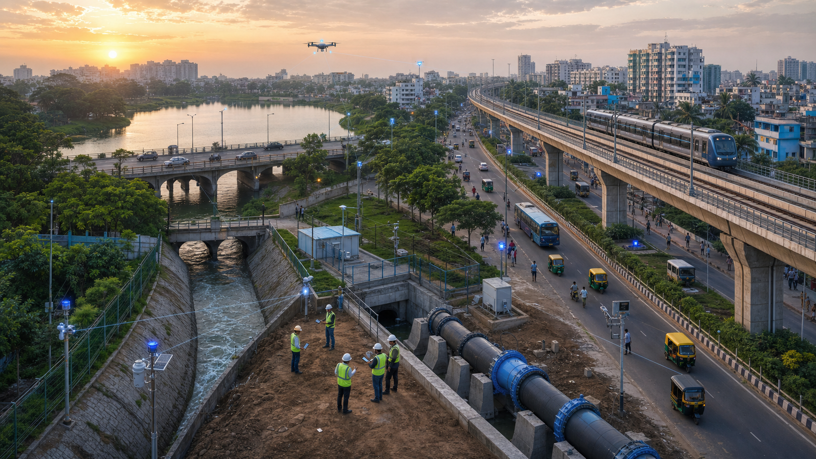
Bharat’s next urban infrastructure challenge is not simply to build more assets, but to maintain an accurate operational picture of the assets already serving its cities. Roads, bridges, drains, lakes, pipelines and transit structures change as their surroundings change; a completion certificate cannot reveal whether they are still functioning as designed.
The practical objective is asset intelligence: a continuing loop that connects authoritative records, observation, field verification, risk assessment and maintenance. This approach would help urban agencies detect deterioration and obstruction before they become floods, transport disruptions or expensive structural failures.
Why urban failures accumulate out of sight
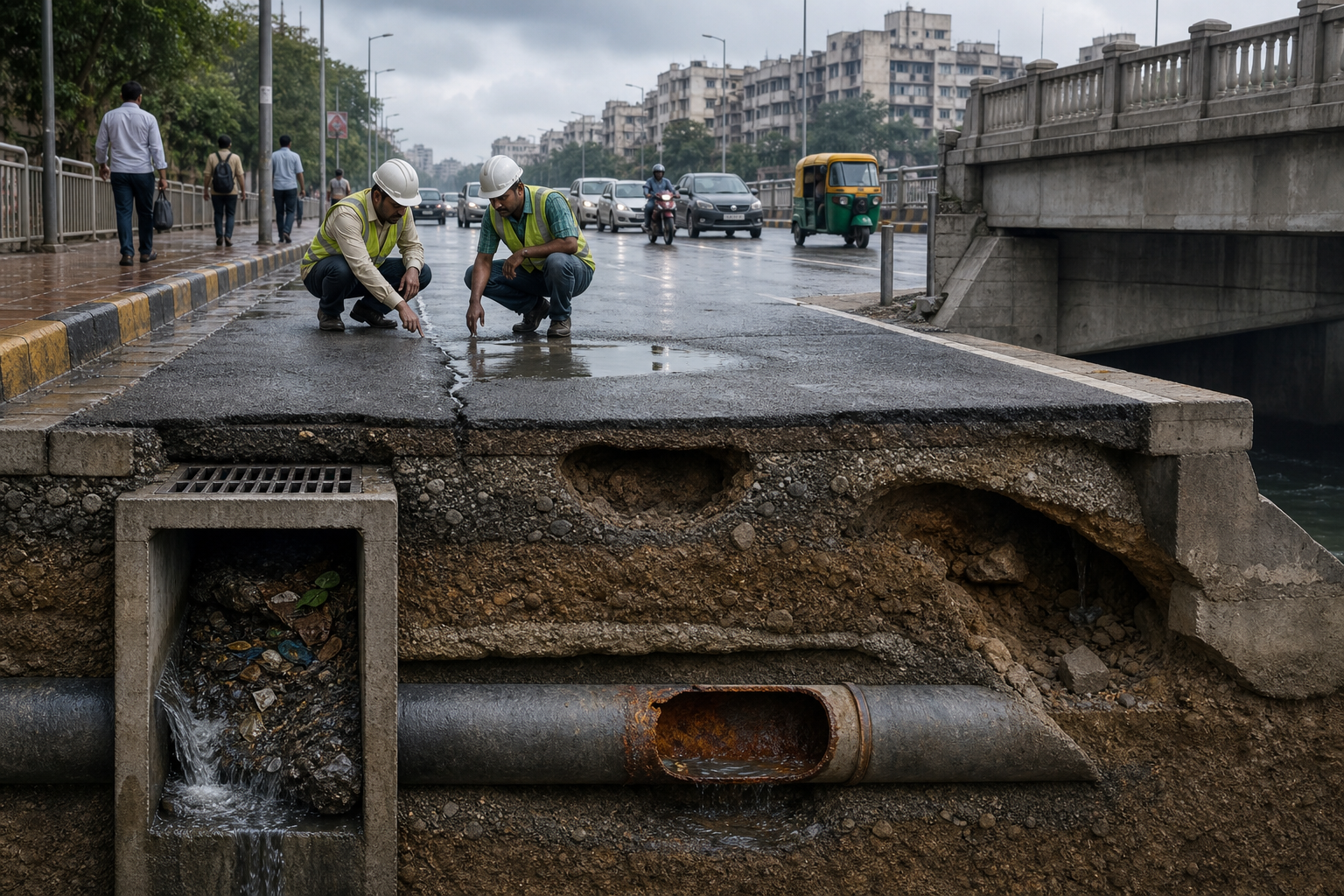
Infrastructure usually fails as part of a system rather than as an isolated object. A drain depends on its catchment and downstream outlet. A road interacts with its side drains, utility trenches and surrounding ground levels. A lake performs several functions only while its boundary, feeder channels and outlet remain connected.
Bengaluru illustrates the consequences of losing sight of those relationships. The supplied DharmaRenaissance Blog article says historical accounts frequently describe the city as having more than 1,400 interconnected water bodies. It reports that only a fraction of that network remains intact and identifies cumulative changes – including narrowed drains, altered lakebeds, raised roads and disconnected feeder channels – as contributors to weakened flood absorption.
This is a monitoring problem as much as a construction problem. Each alteration may appear minor in a departmental file, yet several alterations within one catchment can change how water moves across an entire neighbourhood. The same pattern applies to bridges, roads and utilities: deterioration may begin with a change around the asset long before visible failure occurs.
Fragmented jurisdiction compounds the difficulty. The source article notes that responsibility for a road, the drain beneath it, water and sewage lines, land records, building permissions and disaster response may sit with different bodies. Each agency can therefore hold an accurate fragment while no institution maintains a dependable picture of the place as a whole.
What real-time monitoring should mean for a city
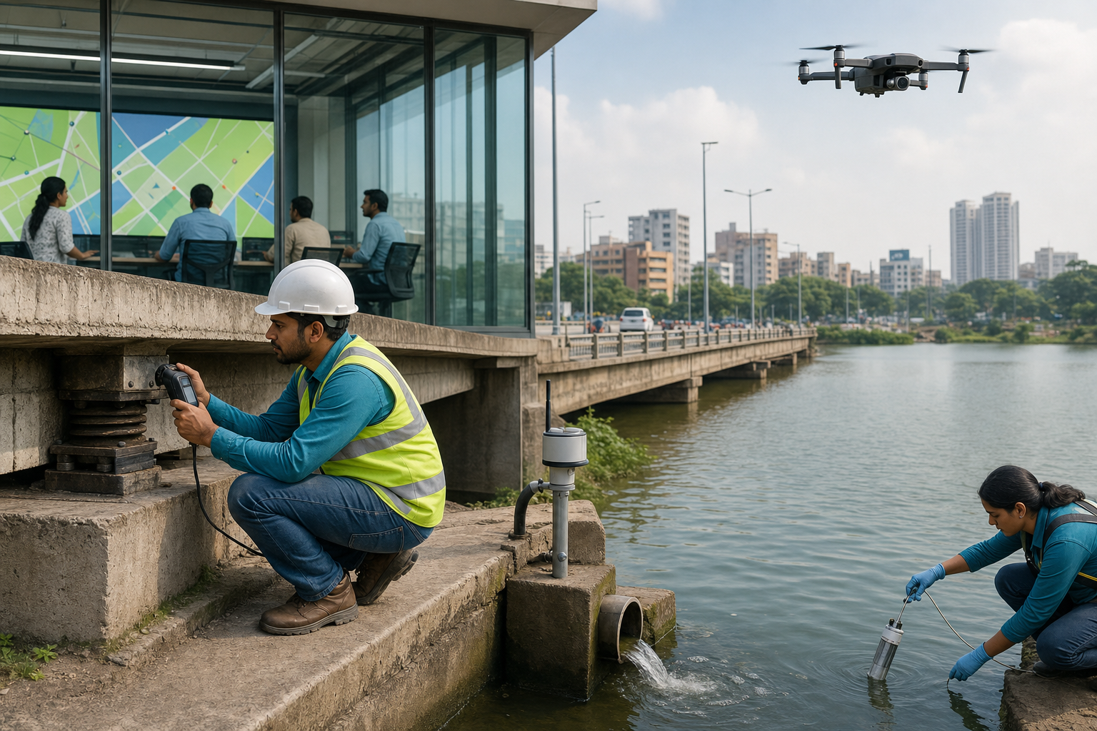
Real-time monitoring need not mean that every asset transmits data every second. In operational terms, information is timely when it is refreshed soon enough to influence the next relevant decision. A structurally sensitive bridge, a flood-prone culvert and a low-risk neighbourhood road may require different inspection frequencies and different evidence.
A useful monitoring system can be organised as five connected layers. The layers are valuable only when information can move from observation to an assigned and completed response.
| Layer | Core purpose | Typical evidence |
|---|---|---|
| Asset identity | Establish what exists, where it is and who owns it | Unique identifier, coordinates, ownership, design capacity and linked records |
| Condition | Record whether the asset still performs as intended | Inspection grades, photographs, sensor readings and maintenance history |
| Surrounding change | Detect risks developing outside the asset boundary | Land-use change, encroachment, utility cuts, altered drainage and complaint patterns |
| Decision | Convert evidence into an accountable response | Risk score, assigned agency, priority, deadline and work order |
| Closure | Verify the remedy and correct the official record | Completion evidence, field validation, timestamp and updated map |
The source article proposes similarly detailed registries. For roads, it identifies pavement condition, drainage connections, utility cuts, traffic loading and accident history as relevant fields. For bridges, it points to structural condition, load limits, bearings, joints, scour risk and inspection photographs. For drains and lakes, it highlights catchments, inflows, outflows, encroachments, silt and flood history.
The important distinction is between a database and an operating loop. Satellite imagery may flag a changed surface, a drone may document an obstruction, and a citizen report may identify a missing cover. None of these inputs completes the job. The anomaly still needs validation, prioritisation, assignment, remediation and a final update to the authoritative record.
The harder problem is institutional integration

Bharat already possesses many of the technical components identified in the source: remote sensing experience, state application centres, geographic information systems, mobile governance tools, satellite imagery, drones, sensors and digital land records. The unresolved questions concern authority and accountability. An effective system must specify who maintains each record, who validates changes, who acts on an alert and who answers when digital data diverges from conditions on the ground.
PM GatiShakti offers a relevant planning principle. As described by the source article, it brings infrastructure layers into a common geospatial environment so that railways, roads, ports, airports, industrial areas and utilities are not planned as unrelated administrative domains. Urban monitoring would extend that principle from project planning into operations and maintenance, where frequently updated condition data matters as much as the original alignment.
The supplied article also points to Karnataka’s lake-geotagging work as a useful direction. It describes the use of satellite imagery, drones, ArcGIS mapping and ground verification, and says reports have covered thousands of lakes while making boundaries, ownership and possible encroachments more visible. The broader lesson is that ecological assets should be represented in the same operational picture as engineered assets because water storage, drainage and built infrastructure affect one another.
Data quality is therefore a governance control, not a clerical concern. A stale map can create false confidence by showing a drain, outlet or road condition that no longer exists on the ground. Every consequential record needs a timestamp, a named custodian, its source of evidence and an appropriate verification status. Citizen complaints and automated alerts can accelerate discovery, but they should remain distinguishable from verified engineering findings.
Key takeaways
- Begin with a complete, uniquely identified asset registry; sensors cannot compensate for uncertainty about what exists or who owns it.
- Monitor the asset’s surroundings as well as the asset, especially catchments, outlets, land-use changes and utility works.
- Set update and inspection frequencies according to consequence and rate of change rather than imposing one schedule on every asset.
- Attach each validated alert to an accountable owner, priority and deadline so that dashboards produce maintenance decisions.
- Close the loop by verifying completed work and updating the official map, condition record and maintenance history.
Turning a monitoring pilot into routine maintenance
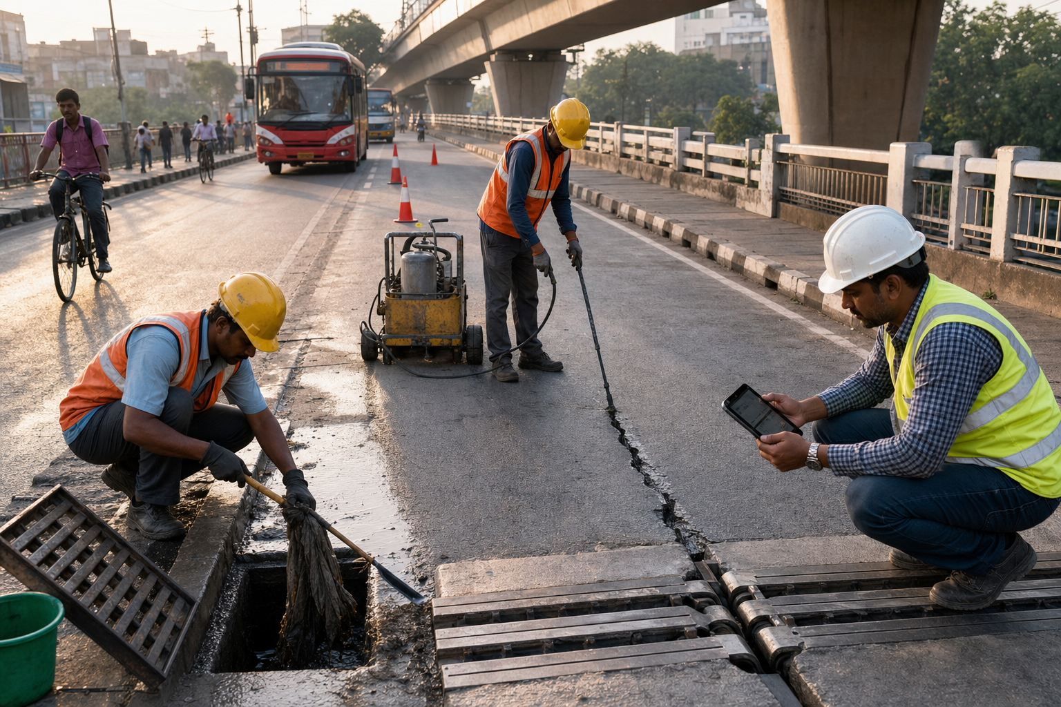
A manageable pilot could begin with one connected urban system, such as a flood-sensitive catchment or a transport corridor with intersecting utilities. Its first task would be to reconcile engineering drawings, land records, geospatial layers and field observations into a verified baseline. Agencies could then define what constitutes a significant change, which evidence requires inspection and which authority must respond.
Evaluation should focus on operational outcomes rather than the number of dashboard layers. Useful measures include the share of records verified within their required cycle, the time from detection to inspection, the time from validation to repair, the frequency of repeat failures and the proportion of work orders that result in updated asset records. Such measures reveal whether information is changing maintenance behaviour.
Scaling should follow demonstrated reliability. Common identifiers and data standards can connect municipal systems with wider geospatial platforms, while local engineers retain responsibility for confirming conditions and closing work. The durable shift will occur when verified maintenance data receives the same administrative attention as new construction: urban resilience will then become a continuous practice rather than a response after disruption.