
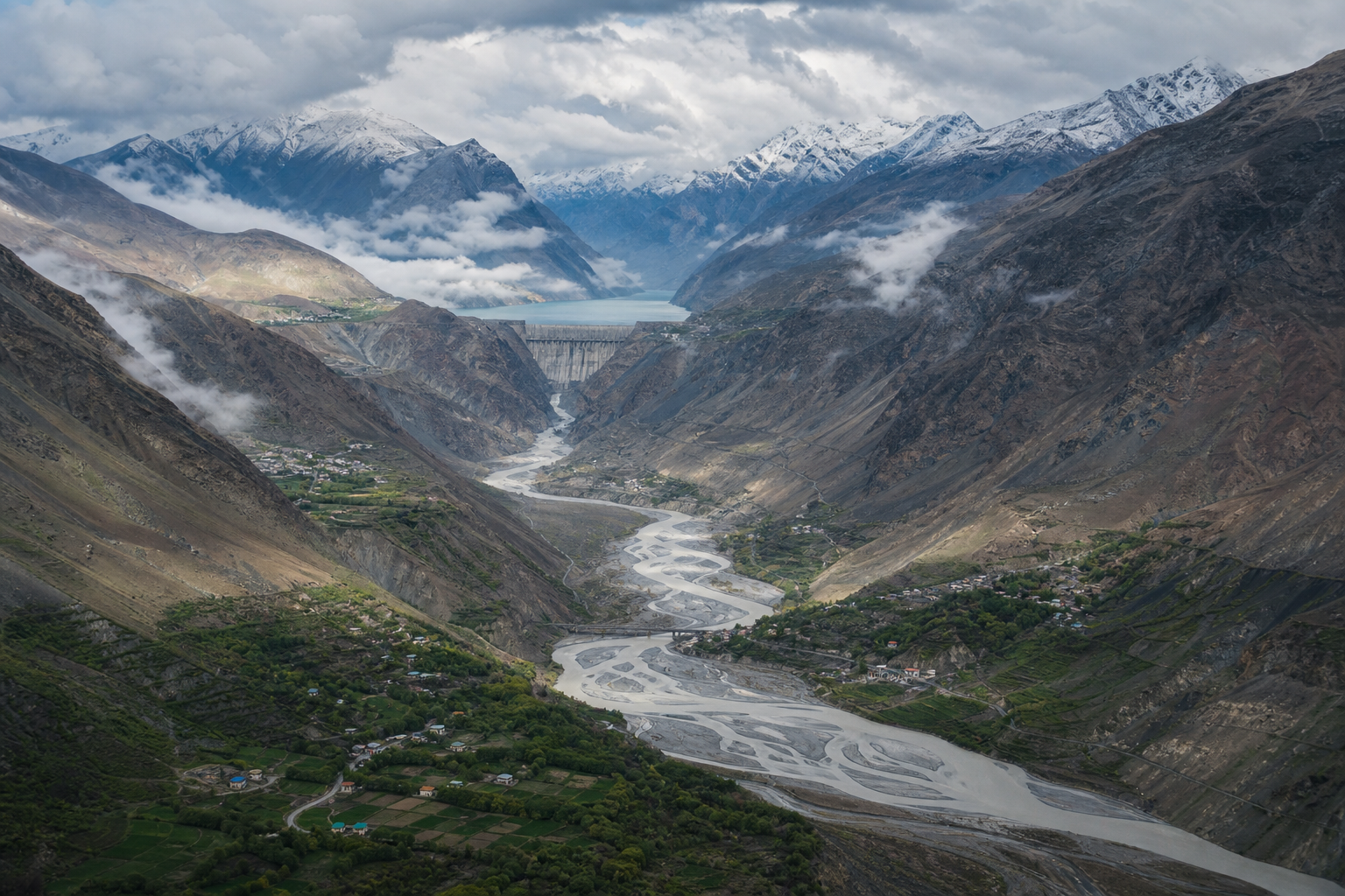
If the words “mega-dam in Tibet” leave you wondering whether Bharat faces an imminent wall of water, begin with a harder but more useful answer: the danger is real, but it is not one single scenario. A glacier collapse, a debris-choked river, an emergency reservoir release and a structural failure are different hazards. They require different warnings and different preparations.
The Nepal-Tibet disaster of 26 August should change what you ask, not what you assume. It does not establish that a dam caused the flood. It shows how quickly an upstream shock can become a downstream emergency in mountains where observation, communication and evacuation time are constrained.
Read the Nepal disaster correctly before drawing conclusions
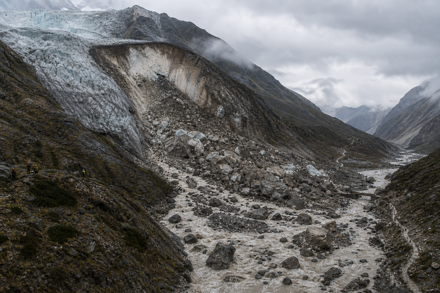
At about 8:40 a.m. on 26 August 2026, a flash flood struck the mountainous Nepal-Tibet border region. Initial scientific assessments indicated that a large section of a Himalayan glacier had collapsed. Ice, rock, mud and other debris entered the river system through a powerful avalanche and debris flow, sending floodwater downstream. Reports of deaths, missing people and extensive infrastructure damage were grave, but the final human toll remained uncertain.
Nothing presently establishes the proposed Yarlung Tsangpo mega-dam as the cause of that event. Claiming otherwise would confuse a warning about Himalayan vulnerability with proof of a particular causal chain. It would also make a legitimate downstream safety argument easier to dismiss.
A disciplined risk assessment separates three layers:
- The hazard is the initiating physical event, such as a glacier collapse, avalanche, landslide, extreme inflow or infrastructure failure.
- Exposure is what lies in the path: people, settlements, roads, bridges, power systems and other essential services.
- Vulnerability is the inability to detect the event, warn people, move them to safety or keep critical systems operating.
A mega-dam belongs in that risk chain as an additional control point and a possible amplifier, not as the automatic explanation for every flood. When you encounter a dramatic claim, ask four questions: What initiated the flow? What increased its force or changed its timing? Who was exposed? Which warning or protective measure failed? Those questions turn anxiety into an auditable safety discussion.
A mega-dam changes risk even when it does not cause a disaster
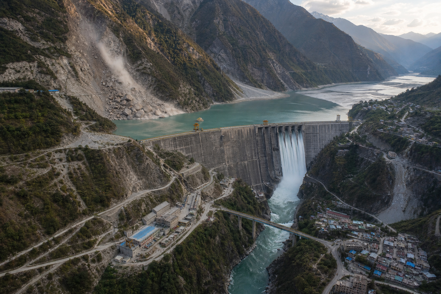
China has been advancing an exceptionally large hydropower project on the Yarlung Tsangpo in Tibet, commonly described as the Medog Dam or Yarlung Tsangpo mega-dam. Its scale, sensitive Himalayan setting and position upstream of other countries make downstream consequences a legitimate matter of public safety and geopolitics.
A reservoir can sometimes retain water and reduce a flood peak. That benefit is conditional. Sufficient storage must be available when the inflow arrives; operators must understand what is entering the reservoir; control structures must remain usable; and downstream communities must receive timely notice if water has to be released.
The same infrastructure can create serious consequences through several different pathways:
- Flow-timing risk: a controlled or emergency release may reach downstream communities faster than local warning systems can respond.
- Compound-hazard risk: ice, rock, mud and debris can arrive with water, reducing the usefulness of plans built around a clear-water flood alone.
- Reservoir-interaction risk: landslides or other geological events around a steep reservoir can alter water levels, storage and outlet conditions.
- Information risk: upstream operators may know the reservoir’s condition while downstream authorities see only a changing river.
- Concentrated-consequence risk: an exceptionally large stored volume places greater importance on design assumptions, maintenance, operating discipline and emergency planning.
Structural failure is the most dramatic scenario, but it is not the only one worth planning for. A release that remains within operating rules can still be dangerous if the warning arrives late, in an unusable form or at the wrong administrative level. Conversely, the project’s enormous scale does not by itself prove that failure will occur. Scale raises the potential consequence and therefore the standard of transparency and preparation that downstream states should demand.
Downstream safety depends on information becoming action

In a fast Himalayan emergency, data is valuable only if it moves through a complete warning chain. A river gauge that nobody monitors, a reservoir alert held inside an upstream control room or a diplomatic message that never becomes a district evacuation order does not protect a family in the flood corridor.
A workable chain has six links:
- Sensors identify abnormal conditions in the river, reservoir or surrounding mountain system.
- Qualified personnel or an agreed automated process validate the signal without avoidable delay.
- The upstream authority transmits a standard alert to designated downstream counterparts.
- National and state agencies convert technical data into a clear operational decision.
- District authorities issue last-mile warnings through redundant channels, including methods that still work when electricity or mobile networks fail.
- Communities follow a rehearsed route to designated safe ground while roads and bridges remain usable.
Each handoff must name the responsible office, the data fields to be shared, the trigger for escalation and the backup when the primary channel fails. “Real-time cooperation” is too vague unless officials can say which measurements are transmitted, how often they are updated, who receives them and what threshold starts a warning.
This is why transboundary river data cannot be treated as a diplomatic courtesy. It is part of civil protection. Bharat should seek timely reservoir levels, inflow and outflow information, gate or spillway status, abnormal release notices and upstream hazard alerts in a format that its own emergency agencies can use immediately. Data arriving after an unusual river rise has already been observed downstream is useful for reconstruction, not early warning.
What Bharat should require before relying on reassurance
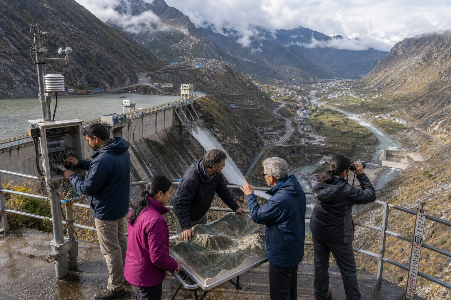
The correct response is neither passive trust nor slogan-driven alarm. Bharat needs a verifiable safety architecture that remains useful whether political relations are warm, tense or temporarily silent.
- Demand multi-hazard scenarios. Planning should cover glacier collapse, avalanche and debris flow, landslide entry into a reservoir, temporary river blockage followed by sudden release, loss of power or communications, controlled emergency discharge, overtopping and structural failure. A plan that models each hazard separately can miss the most dangerous combinations.
- Pursue a formal alert protocol. It should identify contact points, required data, escalation thresholds, message formats, backup channels and acknowledgement procedures. Downstream officials must know that an alert was received and acted upon.
- Maintain independent monitoring. Bharatiya safety should not depend entirely on voluntary upstream disclosure. River gauges, remote observation and analysis of unusual changes should provide an independent picture, while recognising that downstream detection cannot replace upstream warning.
- Map actual exposure. Flood maps must identify settlements, roads, bridges, power assets, communications links, hospitals and evacuation bottlenecks. A technically impressive hazard map is incomplete if it does not show where people can become trapped.
- Exercise the full chain. A tabletop discussion among senior officials is not enough. Drills should test whether a technical signal becomes a public warning, whether backup communications work and whether local authorities can move people without sending them across an exposed bridge or along a riverbank.
- Publish evidence of readiness. The public should be able to find the responsible agencies, basic alert procedure, hazard zones and date of the most recent exercise. Sensitive engineering information can remain protected without concealing whether a functioning safety system exists.
Independent capacity matters because even a cooperative upstream government may face damaged instruments, disrupted communications or incomplete information during a major mountain event. Redundancy is not an accusation; it is a basic feature of serious emergency design.
A dharmic view of river security also clarifies the obligation. A shared river is not merely a volume of water to be controlled or traded. Power over its flow carries a corresponding duty toward life downstream. Bharat should therefore frame transparency, warning and emergency cooperation as obligations attached to upstream control, while building enough domestic capacity to protect its people when those obligations are not met.
Key takeaways for citizens, communities and decision-makers
- Do not circulate the claim that a Chinese dam caused the 26 August Nepal-Tibet flood. The supported conclusion is narrower and more important: a glacier-related avalanche and debris flow demonstrated how rapidly a Himalayan shock can enter a river system and endanger downstream areas.
- When an official promises monitoring, ask for the operational details: which variables, what update frequency, which alert threshold, which receiving authority, which backup channel and when the complete warning chain was last exercised.
- If your household lies in a recognised mountain flood corridor, obtain the local authority’s evacuation route and designated safe area before an alert. Do not plan an improvised route across a bridge or beside the river, where conditions may change first.
- If you work in policy, media or civil society, judge preparedness by published protocols, maps and drills rather than general statements about cooperation or engineering confidence.
- Keep the debate focused on consequence management as well as dam failure. Late notification, unusable data and unprepared downstream districts can turn even a controlled release into a preventable emergency.
The decision before Bharat is not whether to feel alarmed. It is whether concern becomes measurable readiness before the next upstream shock. Ask your district administration and elected representatives where the hazard map is, who receives an upstream alert and when the last end-to-end exercise occurred. If those answers are not available, that is the first risk gap to close.
References
