
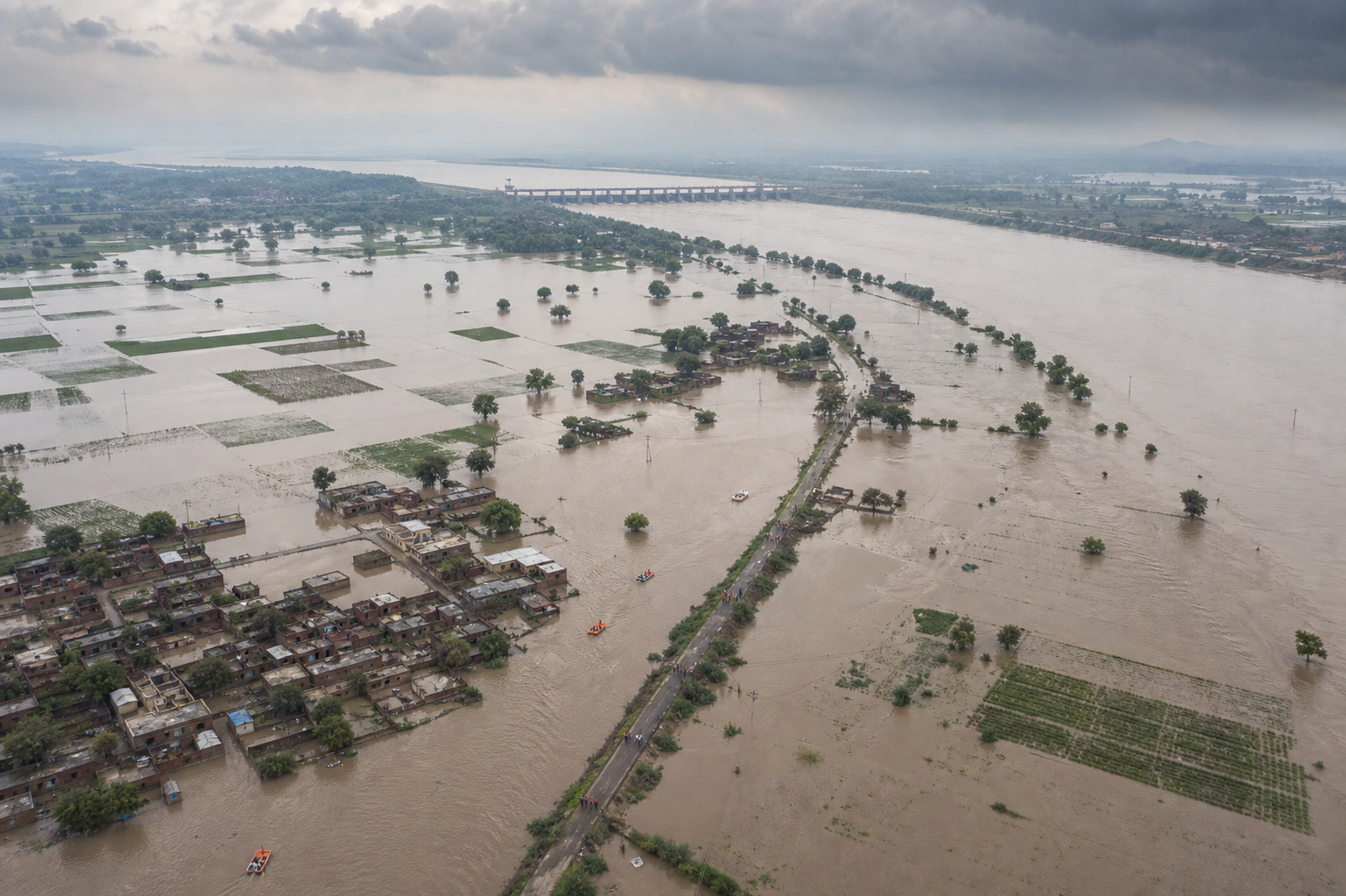
If you are trying to decide whether Punjab’s 2025 flooding was a climate disaster, a dam-management failure, or a planning failure, refuse the forced choice. Extreme water can begin the emergency while damaged drainage, exposed settlements, reservoir decisions, and late warnings determine how destructive it becomes.
The useful task is not to choose a single culprit before the records are available. It is to separate the causes, demand a public timeline, organize relief around verified needs, and make sure rebuilding does not recreate the same danger. That gives you a practical standard for judging official claims, volunteering through a faith institution, or deciding where your donation will do real work.
Key takeaways
- A flood is produced by a hazard, the people and assets exposed to it, and the conditions that make them vulnerable. Heavy rain explains only the first part.
- Claims about dam releases cannot be settled by slogans. You need rainfall, inflow, reservoir, release, warning, and downstream-impact records on one timeline.
- Interfaith goodwill becomes dependable relief only when institutions agree on leadership, roles, stockpiles, communications, and geographic coverage before the emergency.
- Safe water, sanitation, health camps, household cash flow, farm losses, and small-business recovery require attention even after visible floodwater recedes.
- Reconstruction should restore drains, wetlands, village ponds, and seasonal streams while pairing floodplain rules with fair compensation and relocation pathways.
Climate shock does not erase human responsibility
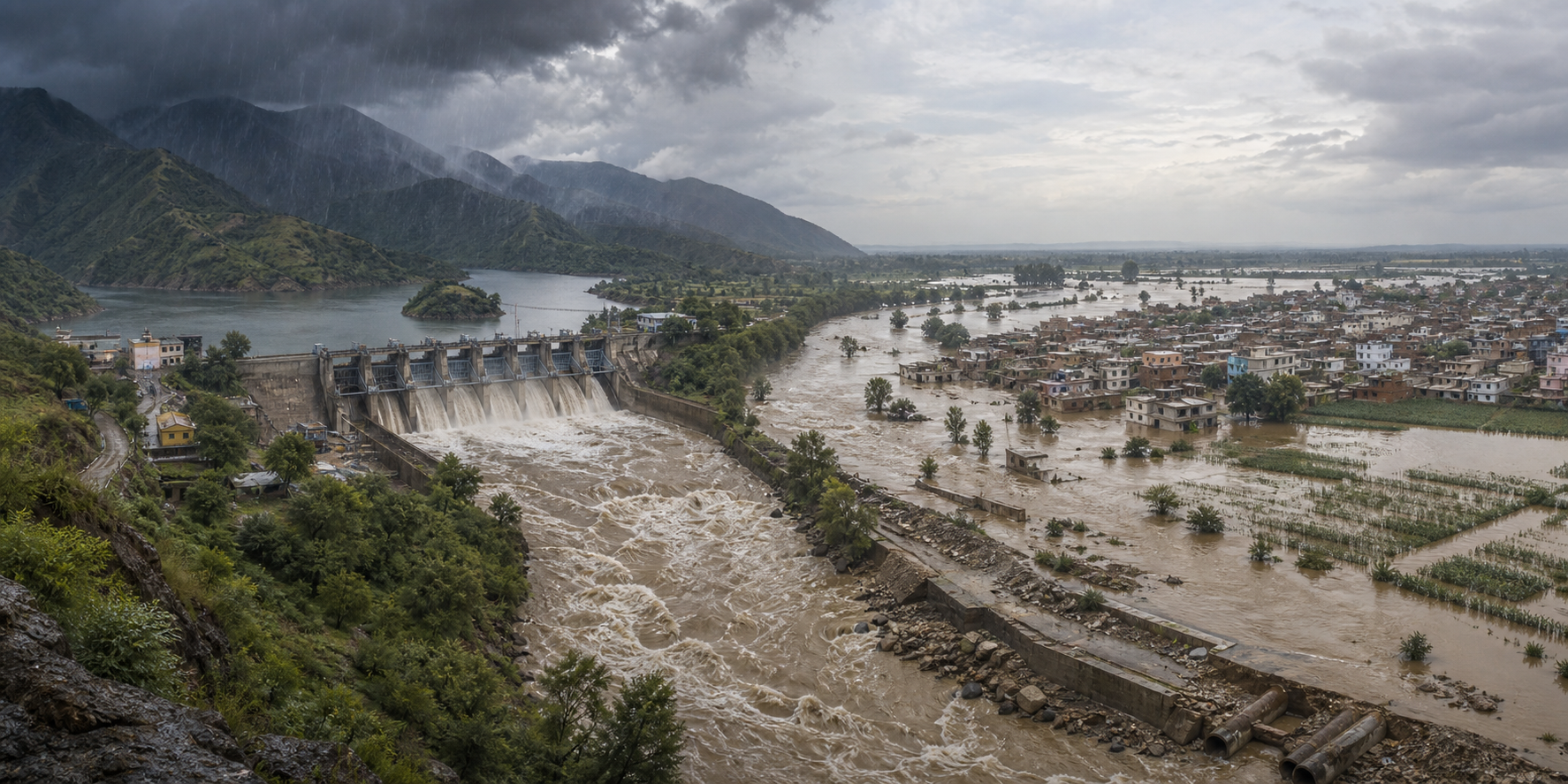
Punjab’s rivers connect local settlements to a much larger Himalayan water system. The Sutlej, Beas, and Ravi can receive heavy inflows when upstream rain falls on saturated catchments. Rapid runoff then places pressure on river channels, reservoirs, embankments, bridges, and local drains at the same time.
Erratic monsoons and high-intensity rain in North India are consistent with the broader risk expected in a warming climate. But consistency is not event attribution. A formal assessment would still be needed before anyone could say how much climate change contributed to this particular flood. That uncertainty should stop overclaiming; it should not be used to postpone climate-aware planning.
A clearer way to examine the disaster is to divide it into three layers:
- Hazard: intense rainfall, saturated catchments, fast runoff, and high river or reservoir inflows.
- Exposure: homes, farms, shops, roads, schools, clinics, and utilities located where water can reach them.
- Vulnerability: weak warnings, blocked drains, encroached floodways, fragile infrastructure, limited evacuation support, and households unable to absorb a prolonged loss of income.
This distinction matters because each layer calls for different evidence and a different remedy. Rainfall forecasting cannot correct construction on a floodplain. A stronger embankment cannot help residents who never receive an evacuation message. A relief kitchen cannot restore a blocked drainage corridor. When officials discuss only the weather, ask what happened to exposure and vulnerability.
Local land and water decisions can magnify a basin-wide surge. Floodplain expansion, encroached drainage routes, silted stormwater networks, altered channels, and unchecked sand mining can reduce the space available for water or change how quickly it moves. Embanking or straightening a stream may protect one location while accelerating water toward another. The correct question is therefore not whether the flood was natural or manmade. Ask which natural forces were unavoidable, which human decisions increased the damage, and which protections failed to perform as intended.
Accountability begins with a public flood timeline
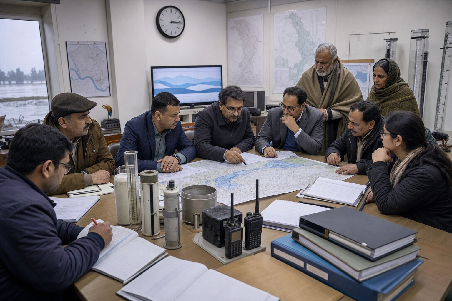
Reservoir operations at Bhakra-Nangal and Pong naturally drew scrutiny. That scrutiny is legitimate, but a release volume viewed in isolation cannot prove good or bad management. Operators balance forecasts, current storage, incoming water, downstream capacity, and the risk that later rainfall will be worse than expected. The decision must be judged against the information available when it was made, not merely against what became obvious afterward.
What a credible review should disclose
Ask for a synchronized chronology rather than separate departmental statements. At minimum, it should show:
- Observed and forecast rainfall across the relevant catchments, with the times at which forecasts changed.
- River inflows, reservoir storage, applicable operating rules, release decisions, and the recorded reasons for those decisions.
- The times when downstream authorities were notified, when public warnings were issued, and which channels carried them.
- Known drainage failures, breaches, blocked corridors, road closures, inaccessible settlements, and shelter availability.
- Coordination among reservoir operators, district administrations, state departments, and authorities across borders.
- The gap between an official warning being issued and residents actually receiving a clear, usable instruction.
This record would distinguish several possibilities that are often collapsed into one accusation. A release forced by rapidly rising inflow is not the same as a discretionary release made without adequate downstream warning. A warning sent to a district office is not the same as a warning received by a family in a threatened village. A drain overwhelmed despite maintenance is not the same as one that had lost capacity through silt or encroachment.
An independent after-action review should cover rainfall analysis, reservoir operations, drainage performance, warning reach, and interdepartmental coordination. Independence alone is not enough. The findings should produce a public improvement register naming the required action, the responsible institution, and the point at which completion can be verified. Otherwise, lessons remain recommendations without owners.
A dashboard must answer the resident’s questions
Public technology is useful only when it reduces uncertainty at the last mile. A flood dashboard should answer four questions in plain language:
- What is happening? Show current rain, river, reservoir, and release information with timestamps.
- What may happen next? Connect forecasts to places, roads, and drainage systems that may be affected.
- What should I do? Publish verified evacuation instructions, road closures, safe shelters, and contact points.
- Who verified this? Identify the responsible authority and show when each notice was last updated.
Dense rain and river gauges, low-cost sensors, and integration with IMD forecasts can improve the underlying picture. Yet a dashboard cannot assume that every household is online or literate in the same language. Multilingual SMS and WhatsApp alerts, community sirens, verified local channels, and crowdsourced flood maps should carry the same message. Repetition across trusted channels is a strength when the information is consistent.
Interfaith sewa needs an operating plan, not only goodwill
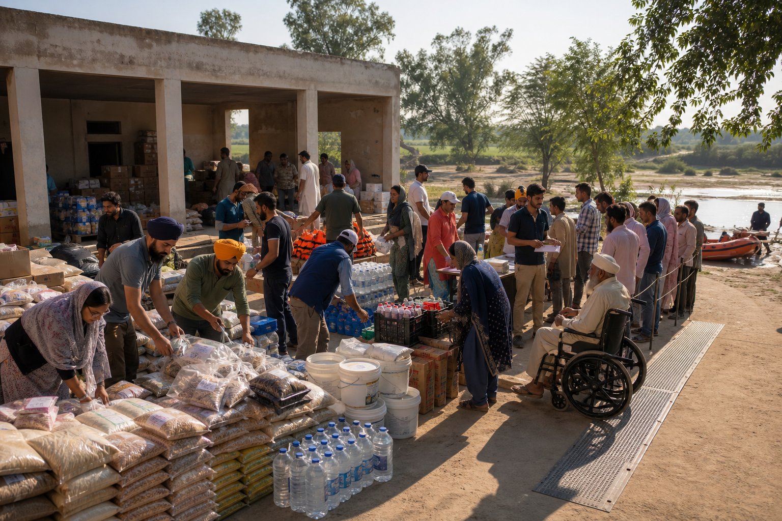
Punjab’s social infrastructure proved as important as its physical infrastructure. Gurdwaras organized langar and sewa, mandirs opened kitchens and shelters, Jain sanghs coordinated medical supplies, and Buddhist groups and youth volunteers supported evacuation and logistics. These were not ornamental gestures of harmony. They moved food, shelter, supplies, information, and human reassurance toward people under pressure.
The next step is to make that cooperation dependable before the next monsoon. A local interfaith relief compact does not merge distinct beliefs or institutions. It creates a shared procedure for serving human beings when roads are cut, communications are confused, and no single organization can see the whole field.
Build the compact before an alert is issued
- Name accountable contacts. Each gurdwara, mandir, vihara, upashraya, sangh, and participating community group should appoint a primary liaison and an alternate. Keep one shared, regularly checked contact list.
- Map real capacity. Record cooking capacity, usable shelter space, vehicles, generators, water storage, trained volunteers, language skills, and accessibility limits. Do not count a hall, vehicle, or kitchen merely because it exists; confirm that it can operate during a power cut or road closure.
- Assign roles and areas. One institution may be strongest at mass meals, another at shelter, another at supply procurement, and another at transport. Allocate geographic coverage as well as functions so visible locations do not receive repeated deliveries while harder-to-reach settlements are missed.
- Agree on activation triggers. State who can activate kitchens, shelters, transport teams, and stockpiles after a verified alert. A compact that depends on an improvised group discussion during the emergency will lose valuable time.
- Maintain a volunteer registry. Record availability and relevant skills, then assign people through a central desk. Annual drills in institutions, schools, and neighborhoods can reveal gaps that a contact list will not.
- Pre-position practical supplies. Tarpaulins, water-purification kits, and other essential materials can be stored across religious institutions rather than in one vulnerable building. Essential medicines should be handled through qualified health partners and organized health camps.
- Use one verification protocol. Mark every evacuation instruction, closure, shelter notice, and supply request with its origin and update time. Maintain a channel for correcting rumors quickly.
Keep aid inclusive, traceable, and tied to need
Dharma becomes public ethics when a distressed person is not asked which path they follow before being fed, sheltered, or evacuated. Sikh sewa, Hindu seva, Jain ahimsa, and Buddhist karuna can retain their particular meanings while meeting in disciplined service. Inclusion is not a public-relations layer added to relief; it is a rule for deciding who receives help.
- Use vulnerability and urgency, not religious identity or social influence, to prioritize assistance.
- Keep a shared intake and distribution record so organizations can see which locations have been served and which remain cut off.
- Publish specific requests for food, water, transport, sanitation supplies, shelter materials, or funds. Uncoordinated donations can consume storage, vehicles, and volunteer time needed for current priorities.
- Protect dignity when recording recipients. Collect only information needed for safe delivery, follow-up, and accountability.
- Designate a handoff point to public agencies for medical care, infrastructure hazards, evacuation beyond volunteer capacity, and longer-term household support.
- Provide donors with a simple account of what was requested, received, distributed, and carried forward.
Sewa can extend reach and trust, but it should not become an excuse for the state to withdraw. Faith institutions cannot set reservoir rules, enforce floodplain zoning, repair bridges, restore electricity, or guarantee public-health surveillance. The strongest model combines capable government with organized community service, each answerable for the work only it can do.
Recovery must protect health, livelihoods, and river room
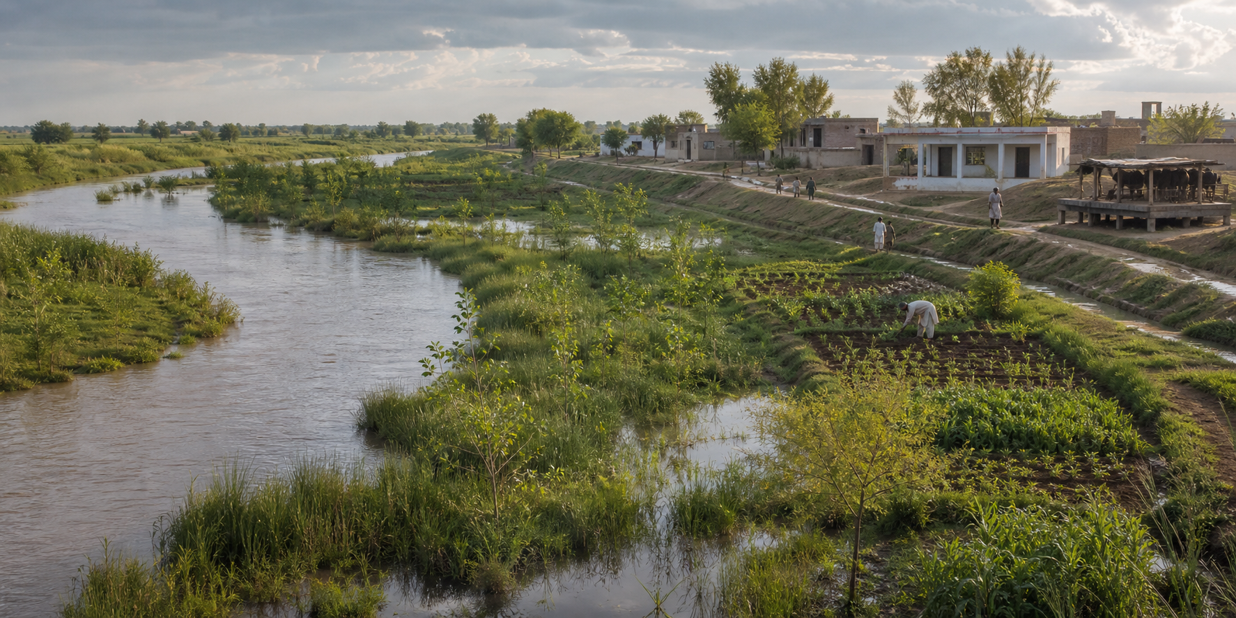
Visible water is only the first stage of the disaster. Stagnant pools, damaged toilets, and contaminated wells can create water-borne and vector-borne disease risks. Farmers may face crop loss and damaged soil, while small businesses can lose inventory and the cash flow needed to reopen. Schools and clinics also remain impaired after roads become passable.
Protect people from the second wave of loss
- Separate safe water from merely available water. A flooded well should not be assumed safe because the water looks clear. Use drinking and cooking water verified as safe, distribute purification supplies with correct instructions, and follow local health directions before returning a contaminated source to service.
- Pair dewatering with sanitation. Debris clearance, damaged toilets, stagnant pools, and waste handling belong in the same operational plan. Moving water without addressing contamination can leave the health threat in place.
- Bring health support near affected communities. Rapid health camps reduce the burden on residents who cannot reach a functioning clinic. Volunteer relief desks should refer medical needs rather than attempting to diagnose or substitute for qualified care.
- Restore essential connections. Roads, bridges, electricity, clinics, and schools determine whether households can return safely and whether local commerce can restart.
- Reach people who are easily missed. Relief registries and outreach routes should explicitly include migrants and elderly residents, not only established households already visible to local institutions.
- Protect household and business solvency. Cash assistance, prompt micro-insurance payouts, and simplified claims can help families and small businesses avoid deeper debt while replacing essentials and inventory.
- Document loss early. Households, farmers, and shopkeepers should preserve safe photographs, inventories, claim records, and official acknowledgements where possible. Community desks can help people organize paperwork without promising an outcome they do not control.
Do not rebuild the same exposure
Repair is necessary, but repair alone can return a community to the exact conditions that failed. Every reconstruction decision should pass a risk-reduction test: does it give water a safer route, reduce the number of people in that route, improve warning time, or make essential services quicker to restore?
- Restore natural storage. Wetlands and village ponds can hold part of a peak flow while supporting groundwater recharge and biodiversity. Treat them as water infrastructure, not vacant land awaiting construction.
- Recover drainage capacity. Desilt urban drains, remove verified encroachments through lawful processes, and reopen buried or obstructed drainage routes where appropriate. Maintenance access must remain part of the design.
- Protect choes. Punjab’s seasonal streams need room to function as living drainage corridors. A dry channel outside the monsoon is not evidence that it is redundant.
- Review channel alteration and sand mining. Enforcement should examine whether extraction, straightening, or embankment has changed flow velocity or redirected water toward settlements.
- Use fair floodplain rules. Zoning should prevent new exposure, but restrictions must come with clear maps, due process, compensation, and credible relocation pathways. Risk reduction without fairness can transfer the cost to households least able to bear it.
- Combine ecology with engineering. Bridges, embankments, drainage works, sensors, wetlands, ponds, and seasonal streams should be planned as one water system rather than as competing solutions.
You do not need to wait for a commission to begin useful work. If you are a resident, identify the verified alert channels, a safe destination, and the relatives or neighbors who may need help moving. If you help run a religious institution, convene nearby faith and community organizations to build the compact and hold an annual drill. If you donate, ask for a current needs list and a distribution record. If you work in civic life or journalism, request the synchronized flood timeline and track whether each promised correction receives an owner and a completion test.
Punjab can honor the courage shown in relief without romanticizing preventable loss. Before the next monsoon, choose one institution you can influence and secure one concrete commitment: a public data timeline, a tested warning route, a mapped relief role, a maintained stockpile, or a restored water corridor. Resilience becomes real when duty has a name, a place, and a date.
References
