
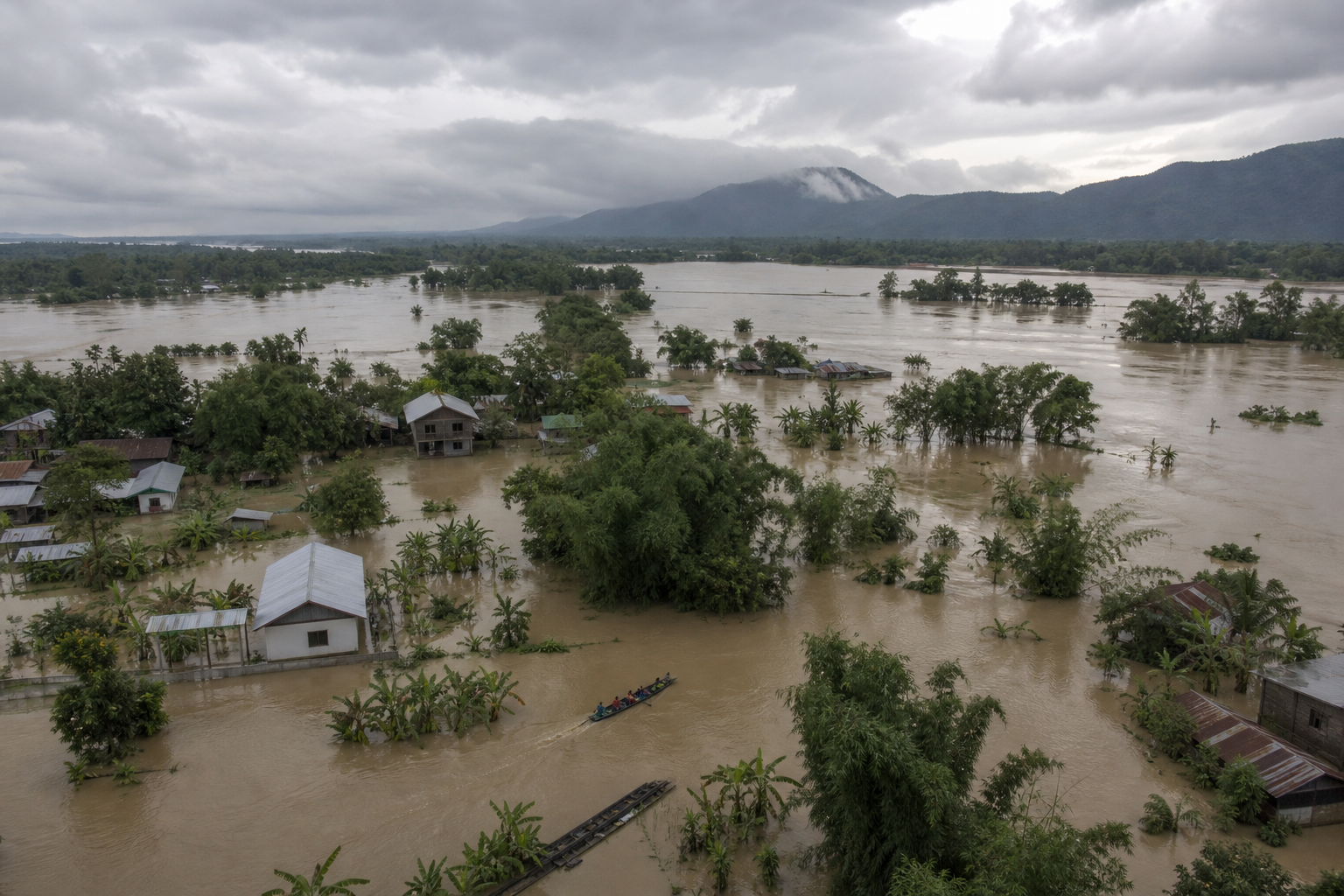
If you are trying to decide whether Assam’s flood was simply the result of heavy monsoon rain, the honest answer is no. But the opposite claim—that one dam release or one destructive activity caused the entire disaster—is also too simple. The flood developed through a chain: sustained upstream rain, rapid tributary flows carrying debris from the Naga hills, already swollen rivers, additional water released from the Doyang project, and infrastructure that could not keep communities connected and protected.
You also need to read reports that the situation has “improved” carefully. Lower water levels can reduce the number of inundated villages while deaths, illness, crop losses and displacement continue to rise. The changing figures tell us that the immediate flood peak was easing—not that Assam’s emergency was over.
What the changing numbers actually mean
An earlier operational snapshot recorded about 7.45 lakh affected people across roughly 935 villages, nearly 50,000 hectares of damaged farmland and at least 61 deaths. Sivasagar was the worst-affected district at that stage, followed by Charaideo, Jorhat, Golaghat, Dibrugarh and Tinsukia, with several other districts also reporting damage.
After rainfall weakened, the later picture showed more than five lakh people still affected, over 750 villages inundated and more than 45,000 hectares of cropland damaged. More than 37,500 displaced people remained in relief camps. The recorded death toll had increased to 68, and some people were still missing.
Those numbers are not contradictory. Flood statistics are time-stamped snapshots, not a final ledger. Water may leave some villages while rescuers find additional casualties or officials revise assessments. You therefore should not subtract one affected-population figure from another and assume the difference represents people who are safe, supplied and back at home.
“Improving” meant that the rain had eased and the inundated area was shrinking. It did not mean that roads were usable, drinking water was secure or livelihoods had recovered. The flood had damaged more than 140 roads and 10 embankments. A large part of Kaziranga National Park and Tiger Reserve was also under water, although conditions inside the reserve were described as under control.
The flood had a chain of causes, not one trigger
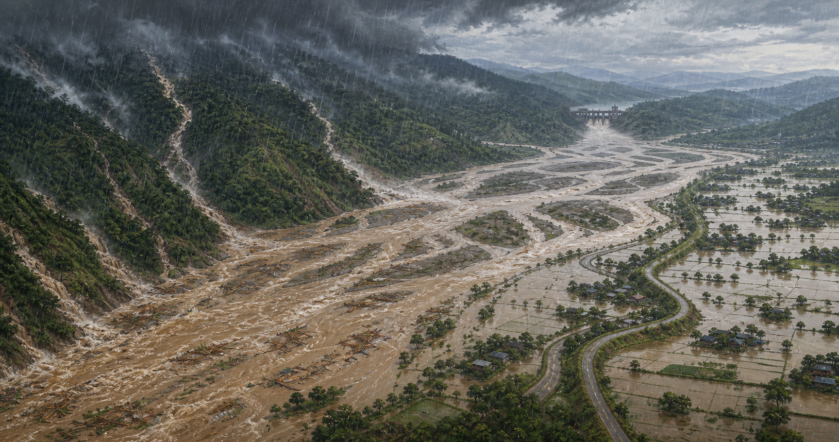
A useful explanation separates three things. The trigger was heavy rain across the connected Nagaland-Assam catchments. Possible amplifiers included forest loss, mining, disturbed slopes, sediment-heavy runoff and the Doyang release. The disaster’s human severity depended on exposure: villages, farms, animals, roads, bridges, embankments and essential services lying in the water’s path.
Heavy upstream rain—but not a verified cloudburst
Continuous heavy rain fell in Nagaland and Assam between 18 and 20 July. Large volumes of runoff descended from the Nagaland districts of Mon, Mokokchung, Longleng and Wokha, carrying debris toward Assam’s lower terrain. Mon district recorded as much as 137 millimetres of rain during the reported episode.
The early “cloudburst” explanation does not hold up. The India Meteorological Department rejected that classification because the required intensity—at least 100 millimetres within one hour over a small geographical area—was not recorded. Assam can suffer a destructive flood without a cloudburst: prolonged rain spread across a large catchment can produce enormous cumulative runoff even when no single location crosses the cloudburst threshold.
That runoff entered a river system already under pressure. The Brahmaputra was above the danger level at several locations, while tributaries including the Burhi Dihing, Disang, Dikhow, Dorika, Dhansiri, Bhogdoi and Kushiyara were in spate at different points. That basin-wide picture matters more than any dramatic label attached to one rain event.
Disturbed hill catchments can accelerate runoff
A forested slope does more than hold trees. Vegetation intercepts rain, roots help maintain soil structure, and porous ground temporarily stores part of the water before releasing it more slowly. When tree cover is removed and slopes are cut, mined or compacted, rain reaches channels faster and often carries more soil and debris with it.
Legal and illegal coal mining, tree loss and unplanned construction in the Naga hills have been identified as possible flood amplifiers. The proposed mechanism is credible: diminished water retention and faster, muddier runoff can raise tributary peaks and increase sediment pressure downstream.
What has not been established is the precise share of this flood attributable to each land-use change. No event-specific basin model, before-and-after runoff series or sediment measurements are available here to assign a defensible percentage. The careful conclusion is that degraded catchments likely increase flood risk and may have intensified this episode; it would be premature to describe them as the independently proven sole cause.
The Doyang release aggravated an already swollen system
Water was subsequently released from the NEEPCO-operated Doyang hydroelectric project, after which conditions in downstream areas became more severe. The release belongs in the causal chain, but it should not erase what came before it: days of rain, heavy natural inflows and rivers already near or above critical levels.
To determine how much dam operation contributed, the public would need the reservoir’s inflow, storage, release volume, release timing, operating rule and downstream warning chronology. Without those records, “the dam caused it” and “the dam had no role” are both stronger claims than the evidence permits. The right accountability question is whether operators minimized downstream risk and gave sufficient warning while managing an extreme inflow.
Infrastructure damage turned flooding into prolonged isolation
A flood does not end when a river begins to fall. Broken approaches, damaged bridges, breached embankments and unusable roads can leave a village without safe water, medical access or a reliable relief route. Thousands of families were reported to be without adequate drinking water and health services as widespread infrastructure damage obstructed delivery.
This is where drainage and maintenance choices become part of disaster policy. Assam Congress president Gaurav Gogoi alleged that roads and flyovers had received greater priority than drainage and flood-management programmes, while Sivasagar legislator Akhil Gogoi called for stronger preparedness and blamed unregulated construction, mining and forest destruction for worsening the flood. These are political claims that require scrutiny, but they point toward measurable questions: which drains failed, which embankments were vulnerable, which roads blocked natural flows, and which planned protections were incomplete?
The emergency changes after the water starts falling
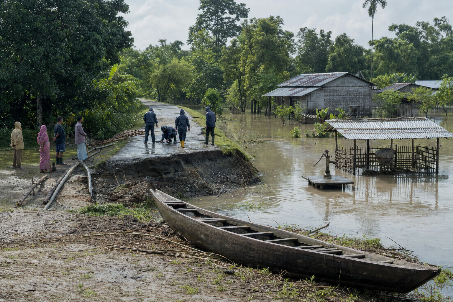
During the peak, the immediate job is rescue. SDRF, NDRF, Army and Air Force personnel worked with district authorities and volunteers, while at least 250 relief camps and numerous distribution centres were established during the earlier phase. Once rainfall eases, the work shifts toward safe water, public health, access restoration and evidence-based assessment of crop, animal and business losses.
If you are in or near an affected area
- Follow district evacuation and access instructions even if the water near your home appears to be receding. A familiar road or embankment may have suffered damage that is not visible from the surface.
- Use drinking water supplied or approved through a reliable relief channel. Floodwater can contaminate ordinary sources after the river has withdrawn.
- Report illness early through a relief camp or health service. Authorities specifically warned of possible waterborne and mosquito- or insect-borne disease after the flood.
- Keep a dated list and photographs of crop, livestock, household or business losses, but only after officials consider access safe. Preserve identity, land, bank and livestock records where possible; damage assessment and eligibility decisions depend on documentation.
- Treat a falling river as the start of recovery, not an all-clear. Continued rain upstream or another managed release can change downstream conditions faster than the weather above your own village suggests.
If you are donating or volunteering
Coordinate first with the local administration or a field organisation that can name the village, current access route and unmet requirement. The useful relief basket in this emergency included drinking water, dry food, tarpaulins, candles, soap and mosquito-repellent coils. Medicines should move through authorised health workers who can store and distribute them appropriately.
Local reach matters as much as the quantity collected. RSS swayamsevaks and Sewa Bharati workers rescued more than 200 people in the Betbaria area of Sivasagar, delivered materials in several stranded communities and helped move children, older people and ailing residents to administration-run camps. The operational lesson is straightforward: map needs village by village, coordinate transport with authorities and verify that supplies reached families rather than stopping at a central collection point.
Key takeaways
- The flood was triggered by sustained rain across connected Nagaland-Assam catchments; the available rainfall did not meet the official cloudburst definition.
- Lower affected-population and village counts indicated that inundation was easing, but the death toll still rose to 68 and more than 37,500 people remained in relief camps.
- Mining, deforestation and disturbed slopes in the Naga hills provide a plausible mechanism for faster, sediment-heavy runoff, but their precise contribution to this event has not been quantified.
- The Doyang release aggravated a river system already swollen by heavy inflows. Release records are needed before assigning it either total responsibility or none.
- The next risks lie in unsafe water, disease, damaged access, lost crops and animals, and a recovery process that may outlast the visible flood.
What Assam should demand before the next monsoon

If you want meaningful accountability, ask for records rather than a single convenient villain. Assam and Nagaland share catchments, tributaries and downstream consequences. Flood management therefore has to follow the water across state boundaries.
- Publish a common flood chronology. It should align hourly or otherwise sufficiently detailed rainfall, river levels, tributary peaks, reservoir inflows, releases, warnings, embankment failures and village inundation.
- Audit land use in the Naga hill catchments. Map legal and illegal mining, forest clearance, slope cutting, debris disposal and restoration obligations against the tributaries that enter Assam.
- Make dam operations transparent. Release time and volume, reservoir storage, incoming flow, downstream forecasts and warning delivery should be available for post-event examination.
- Review infrastructure by hydraulic function, not only by repair cost. Investigators should determine whether roads, culverts, drains and embankments conveyed water as designed or unintentionally trapped and redirected it.
- Measure relief at the last mile. Camp totals are not enough; public dashboards should show whether isolated settlements have potable water, health access, sanitation and a functioning supply route.
- Keep livelihood recovery in the assessment. The earlier flood picture included nearly 50,000 hectares of damaged agriculture and more than 1.25 lakh domestic animals, including poultry, swept away. Farm households need to appear in the recovery plan after rescue coverage disappears from daily attention.
An inter-ministerial central team was expected to assess losses and determine the assistance needed for livelihood restoration, while the Assam government announced ex gratia support of four lakh rupees for each family that lost a relative. The durable test will be whether the resulting assessment, rehabilitation priorities and catchment-management decisions become visible before another monsoon tests the same weaknesses.
For now, judge every update by its district and timestamp, not by the word “improving.” If you are helping, verify the latest village-level need. If you are asking questions, demand the rainfall, river, dam, land-use and infrastructure records that can turn this calamity into a preventable lesson.
References
- Hindu Post — नागा पहाड़ियों में विकास परियोजनाएं और अवैध खनन: असम की बाढ़ त्रासदी का कारण
- Hindu Post — As rains descent, Assam flood situation improves